The Map Room
If you see needed corrections to any map indexes, please submit request here. Click here for grid map input form.
Chart of Buzzards Bay and Vineyard Sound 1776
Click here for link.
Click here for link.

This is an old British chart from 1776 from the Library of Congress. It shows the coastline around Buzzard's Bay, including the present areas of Fairhaven, Acushnet, New Bedford, Dartmouth, Westport, and the Elizabeth Islands. Although published April 25, 1776, it was probably created in 1775, which is also before the attack on Dartmouth by the British in 1778.
1850 Rhode Island Walling Maps
Click maps below.
Click maps below.


1855 Fairhaven Walling Map
Click map below.
Click map below.

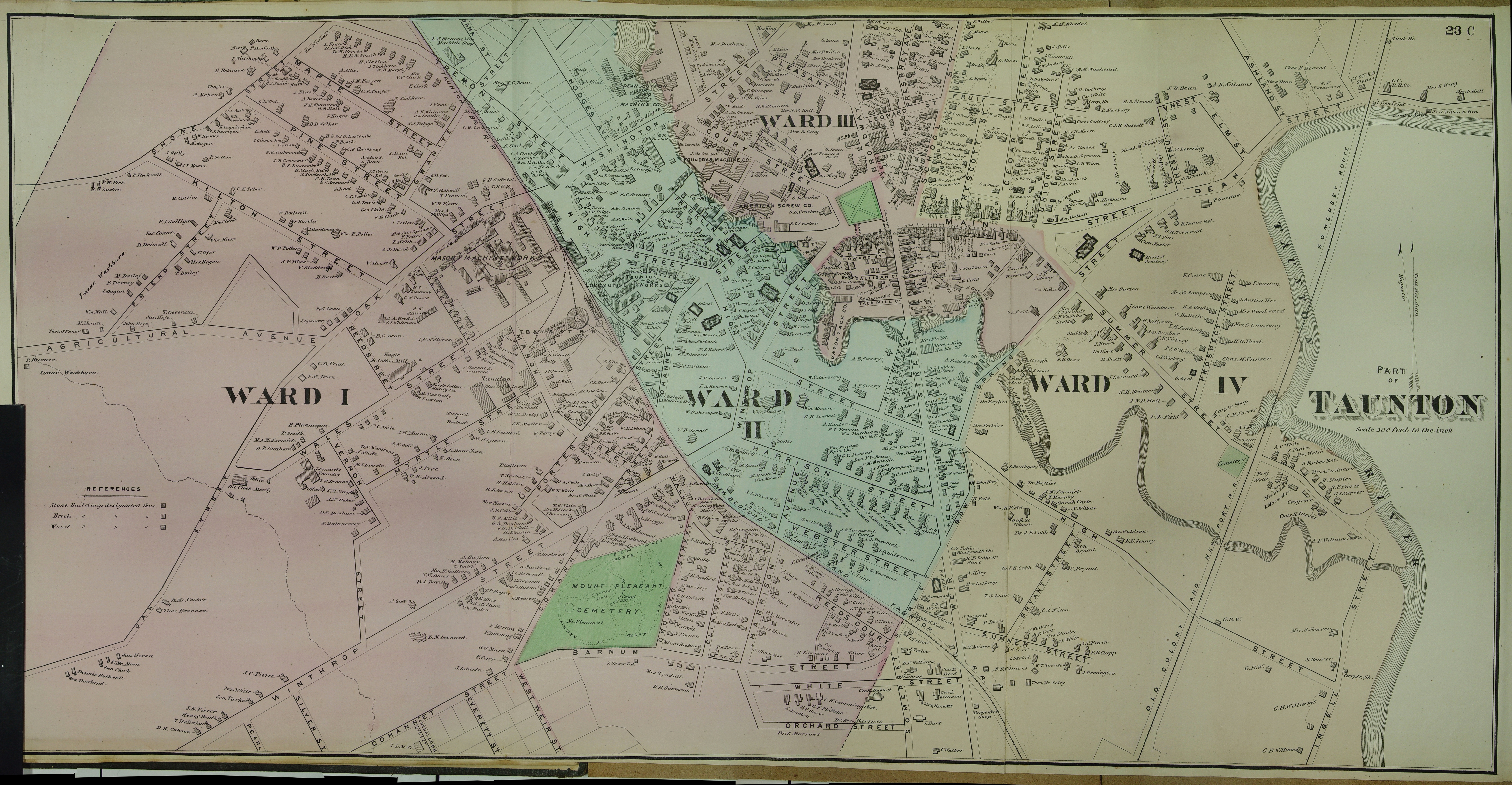
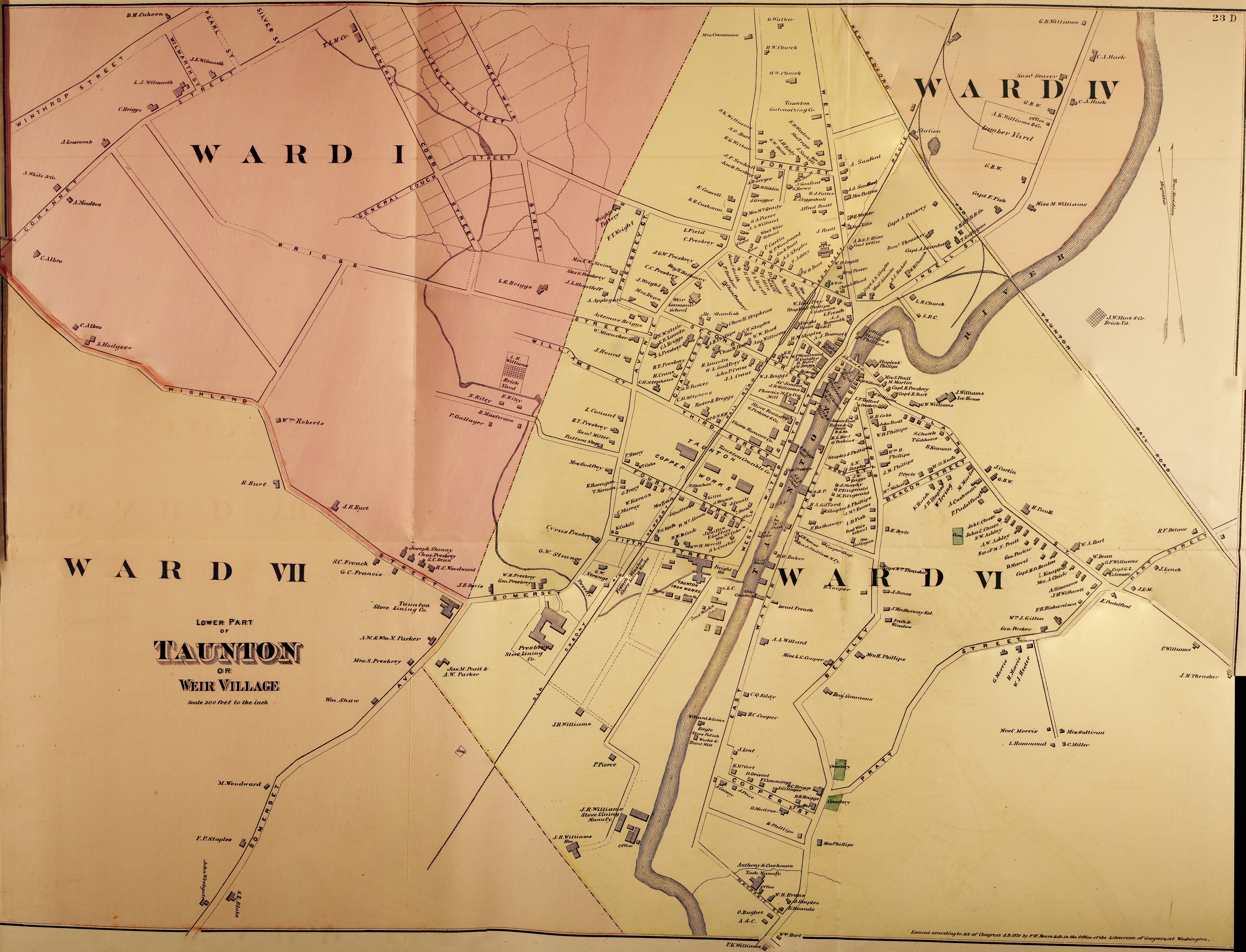
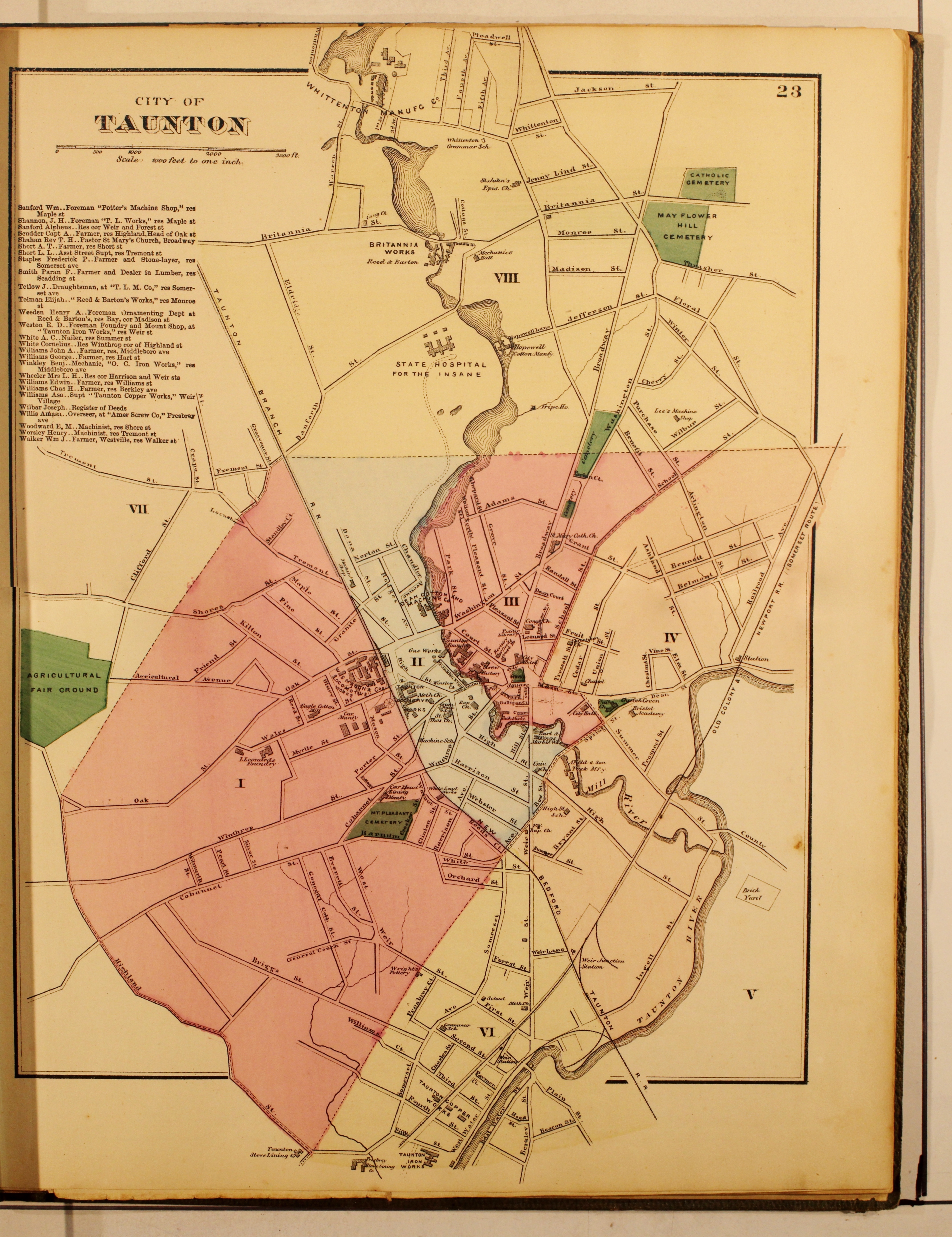
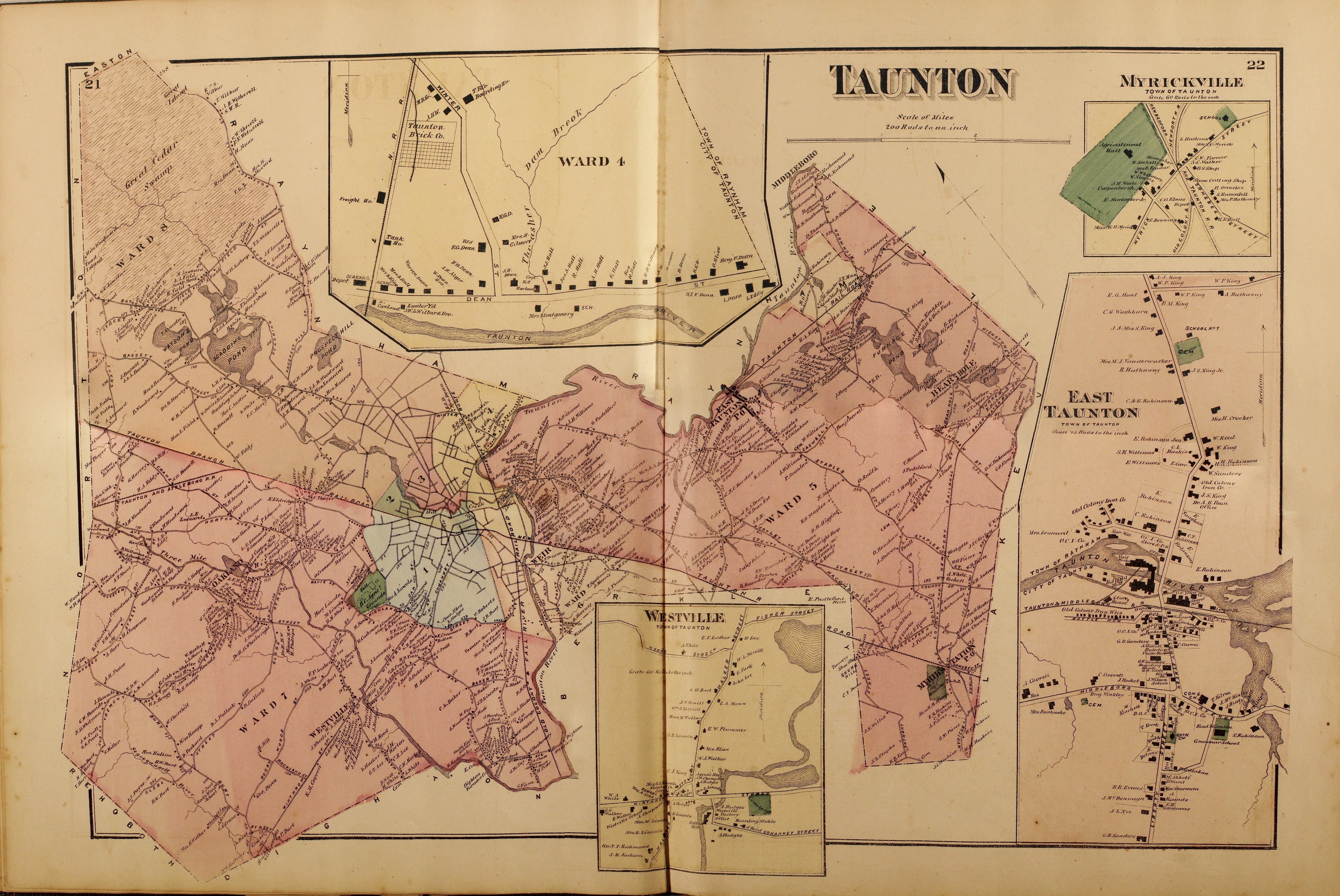
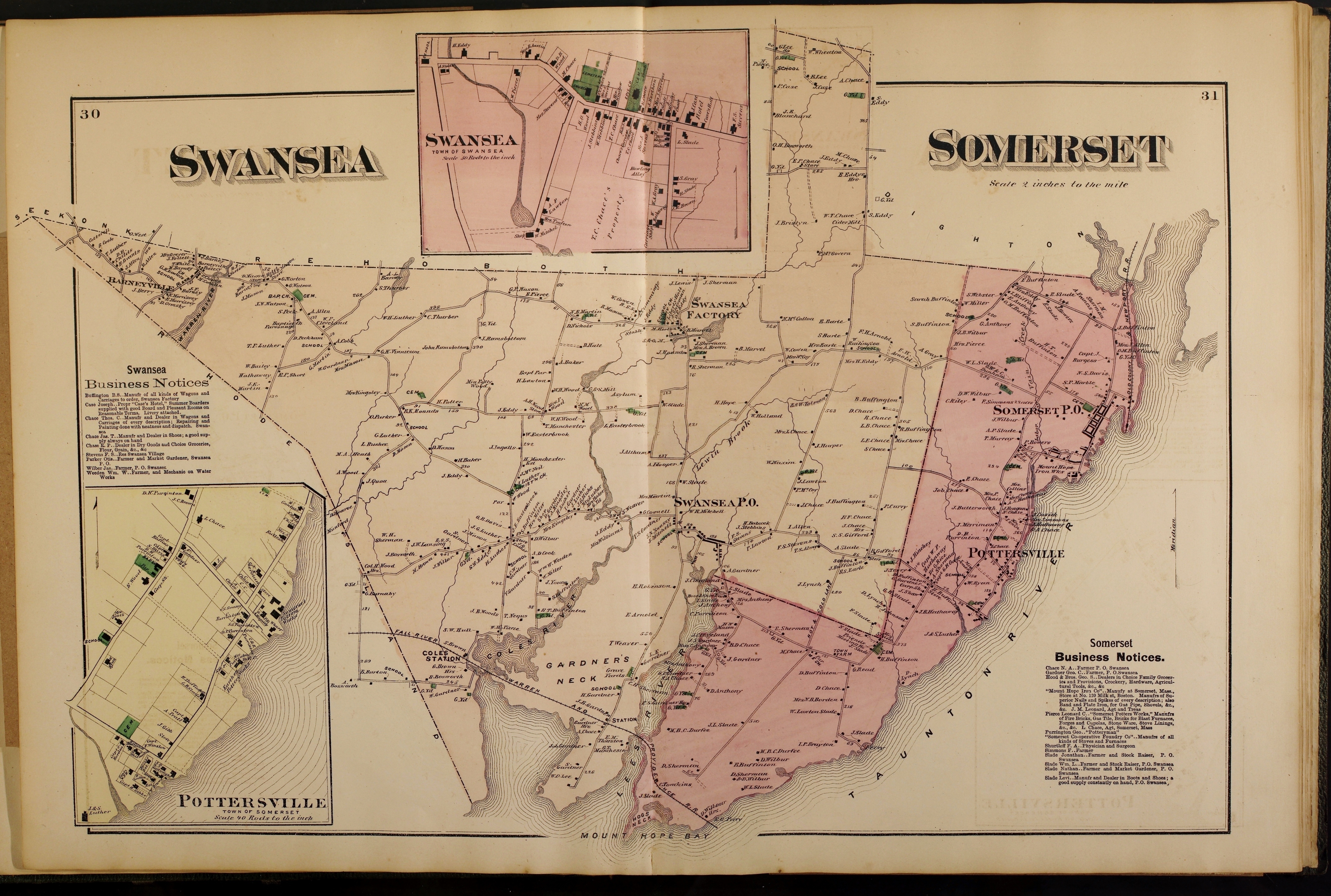
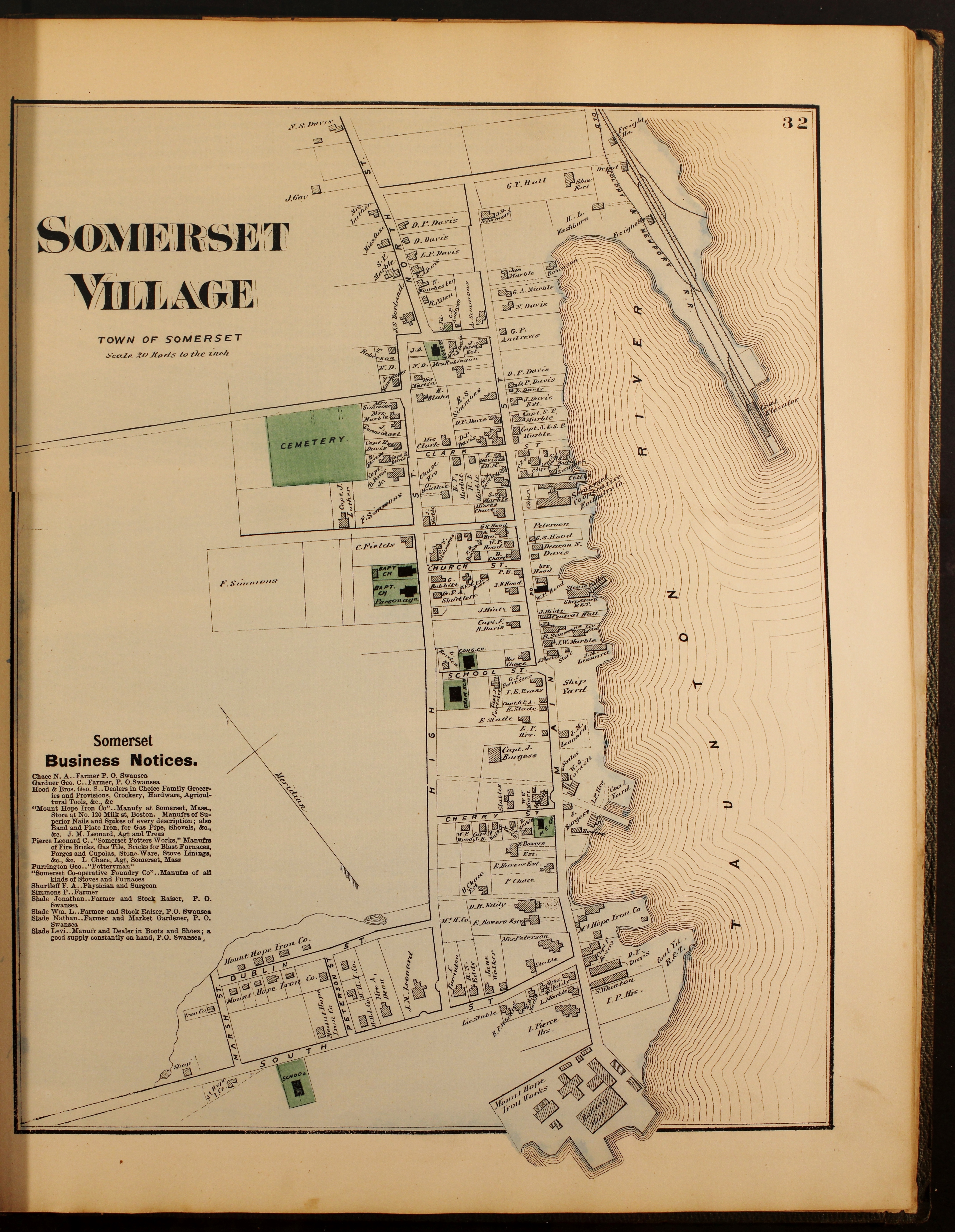
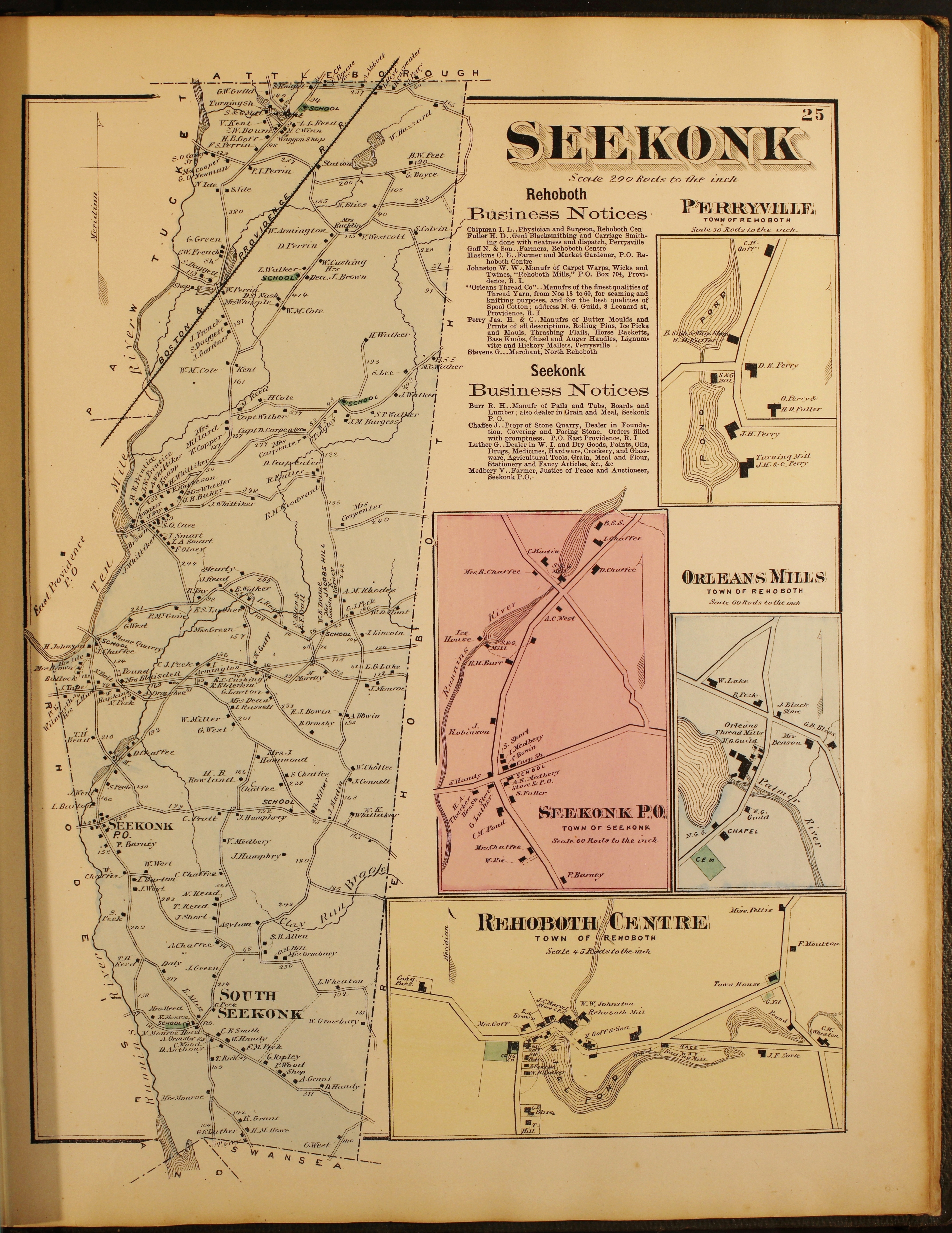
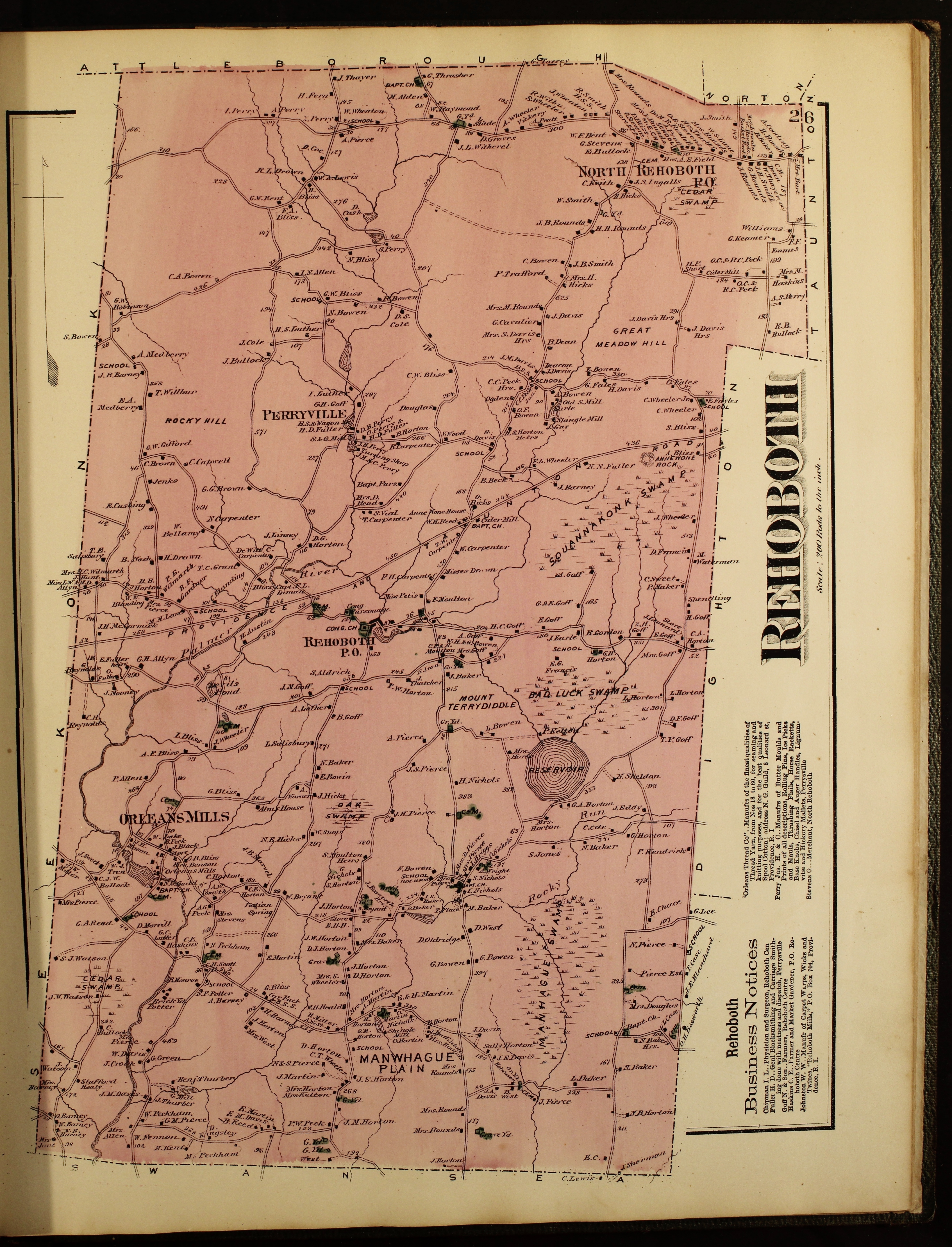
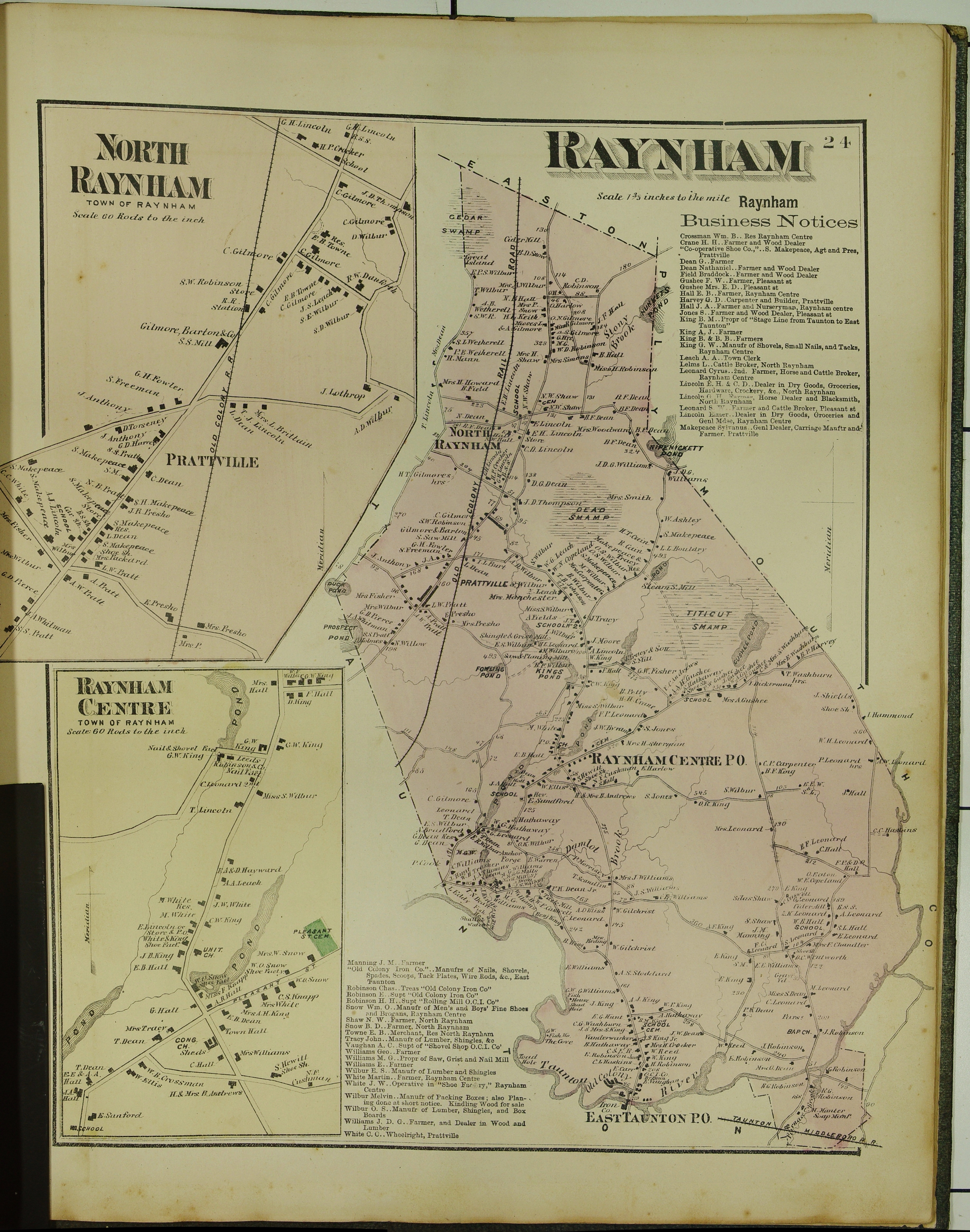
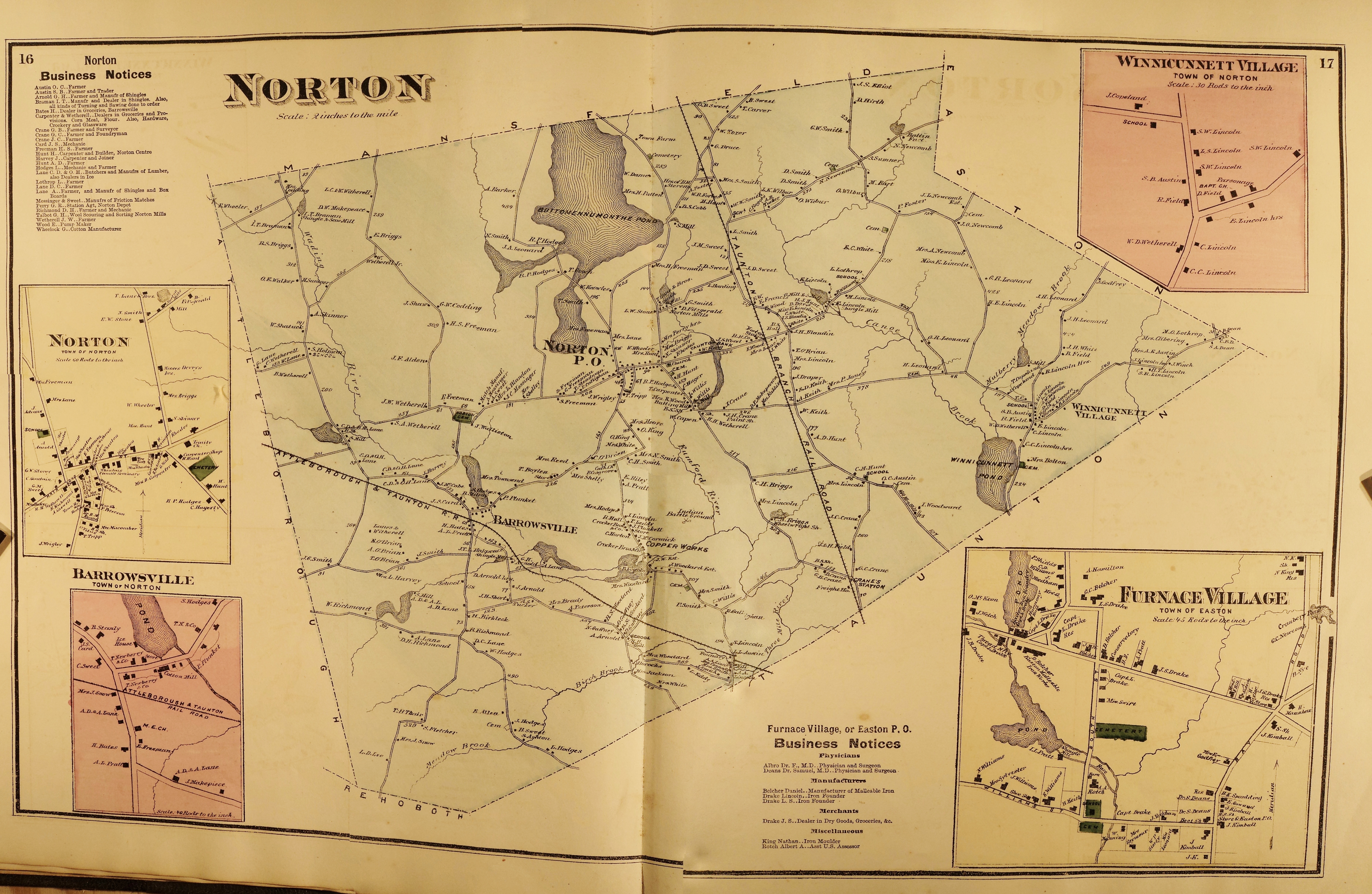
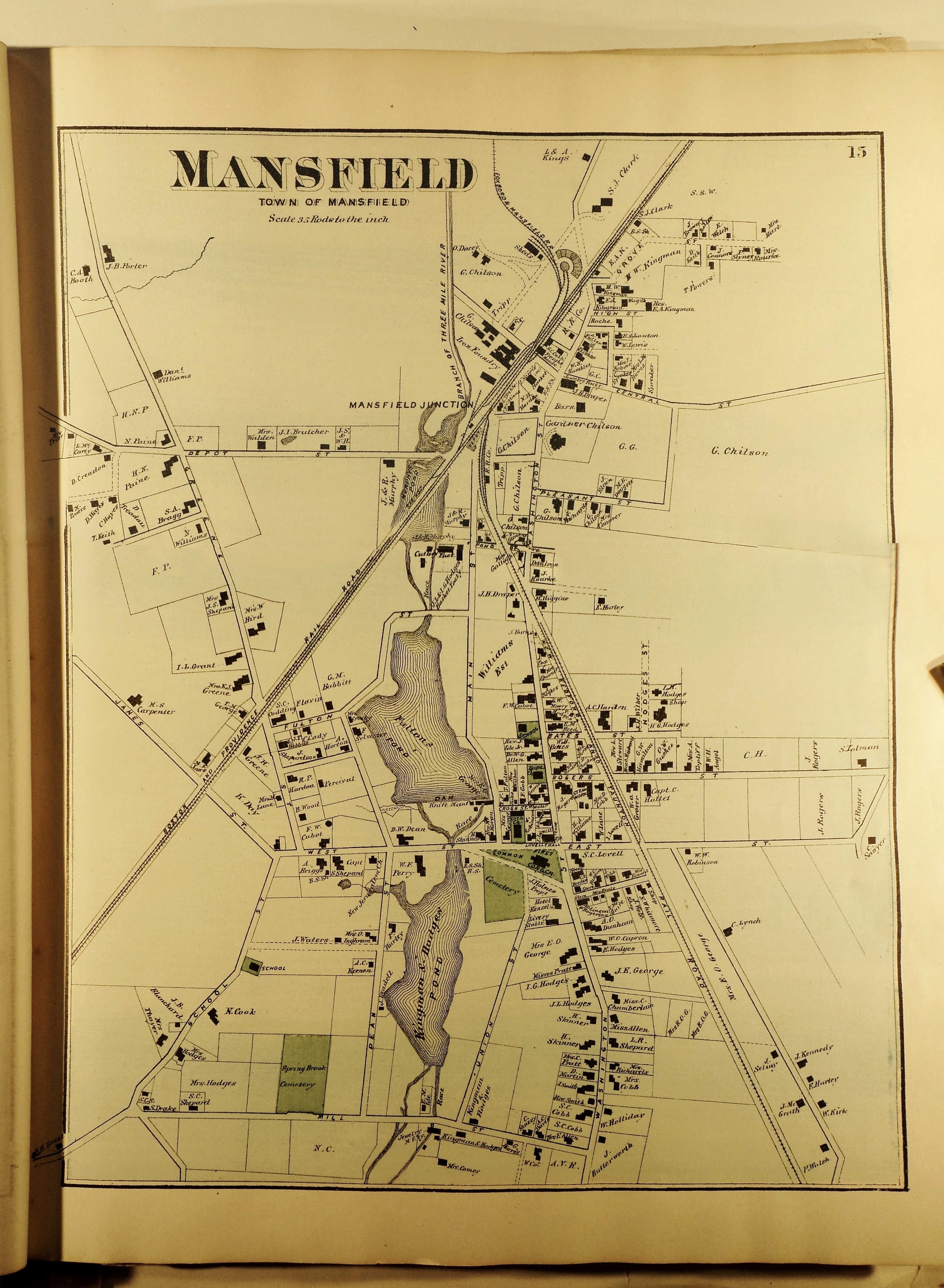
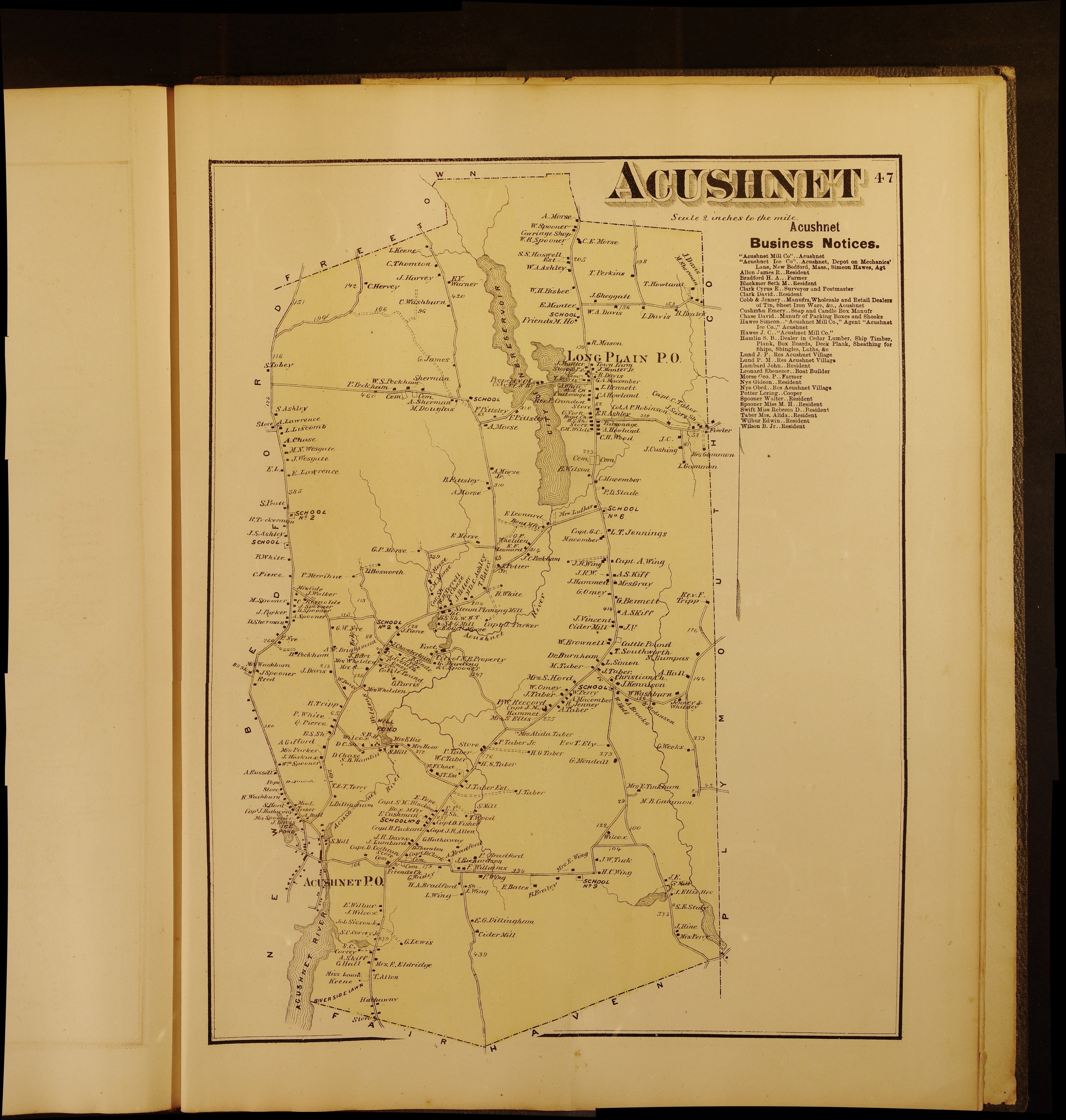
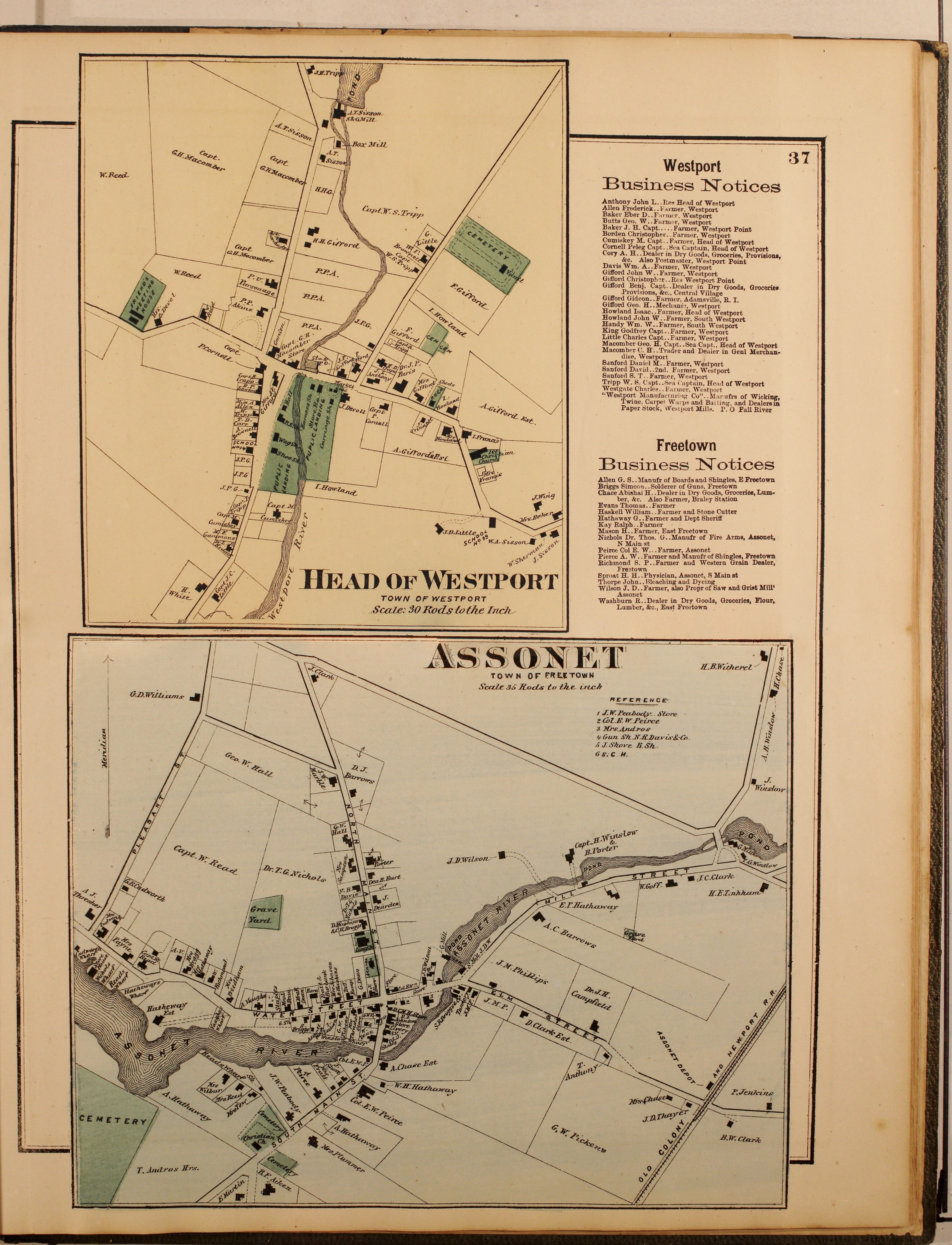
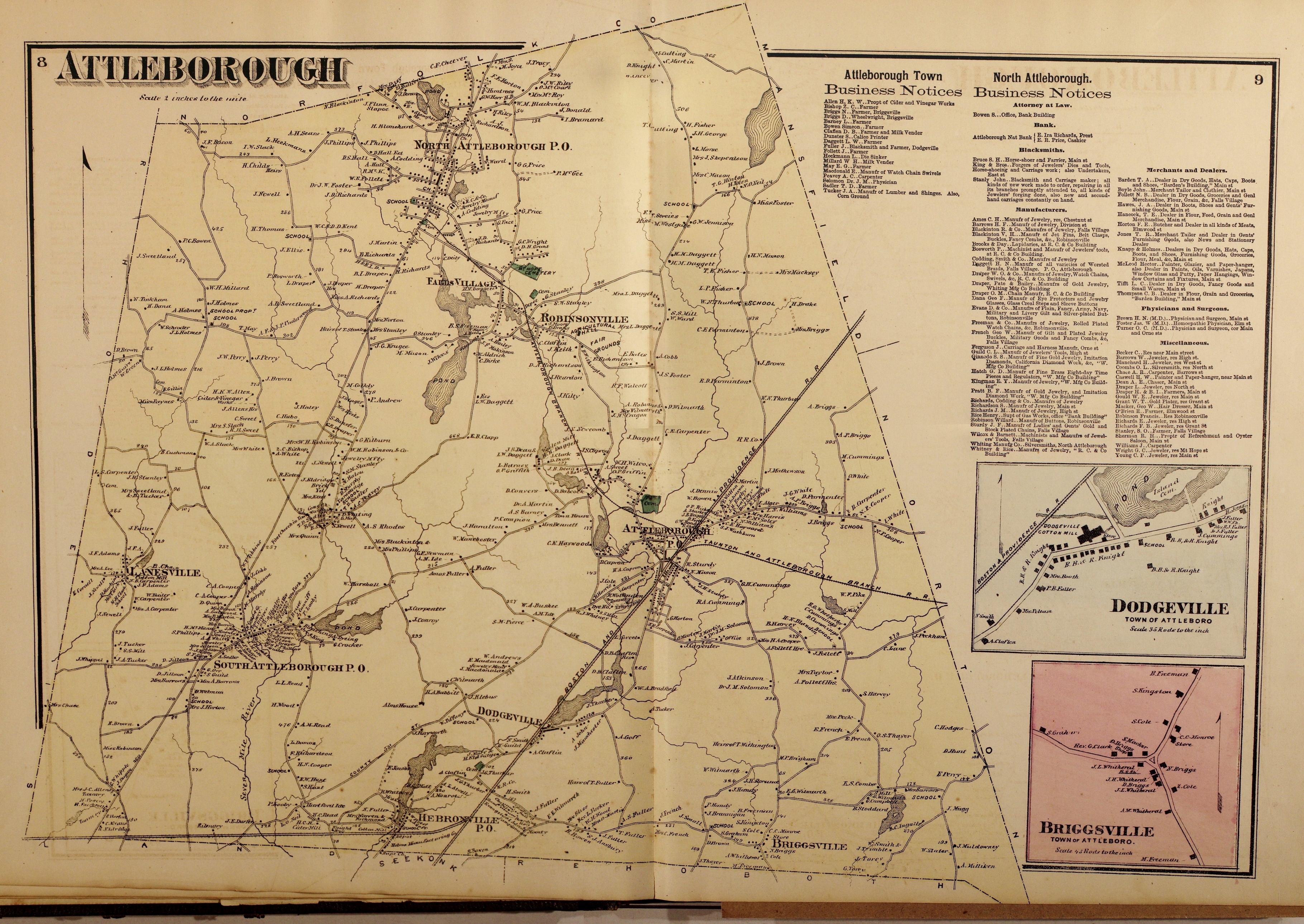
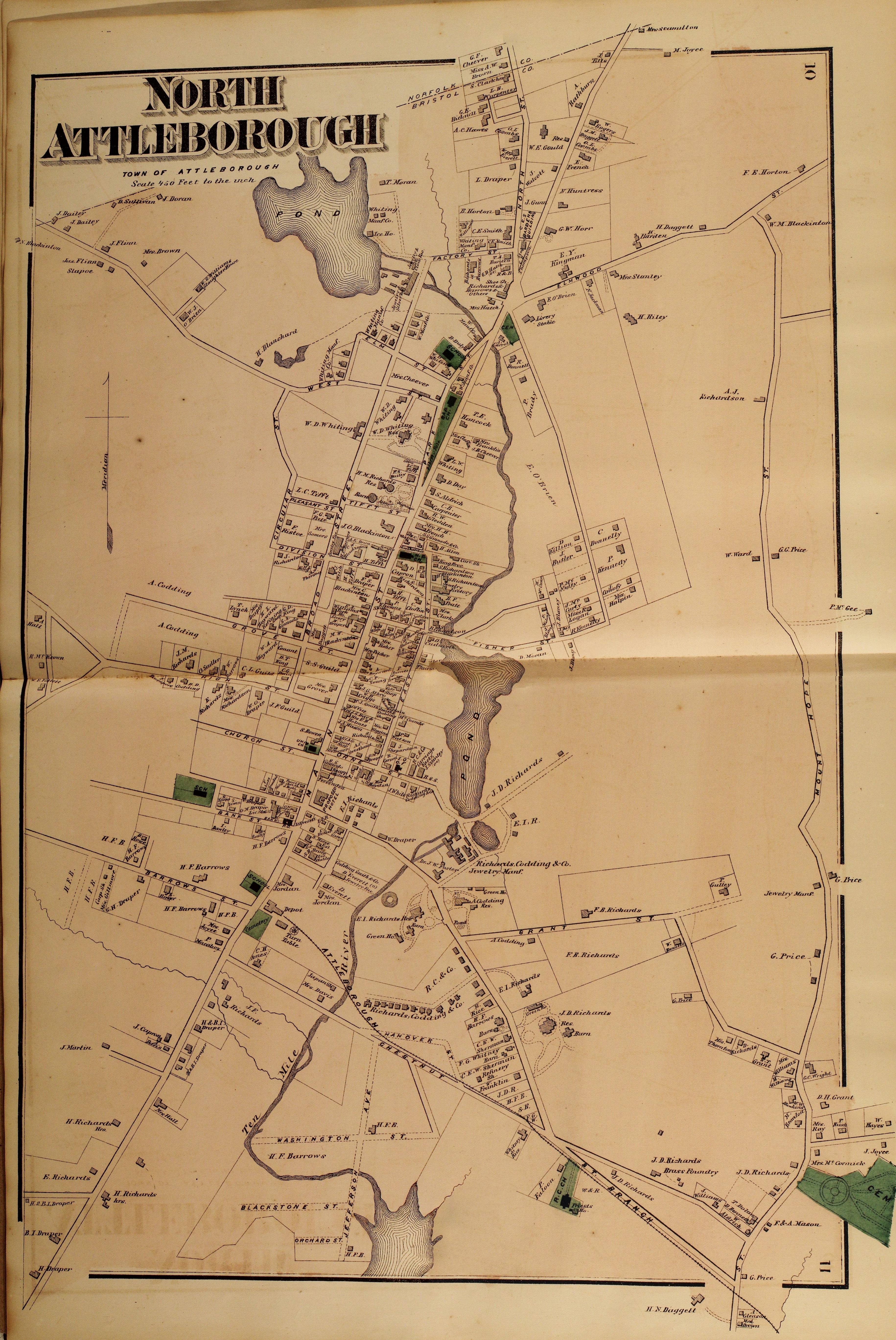
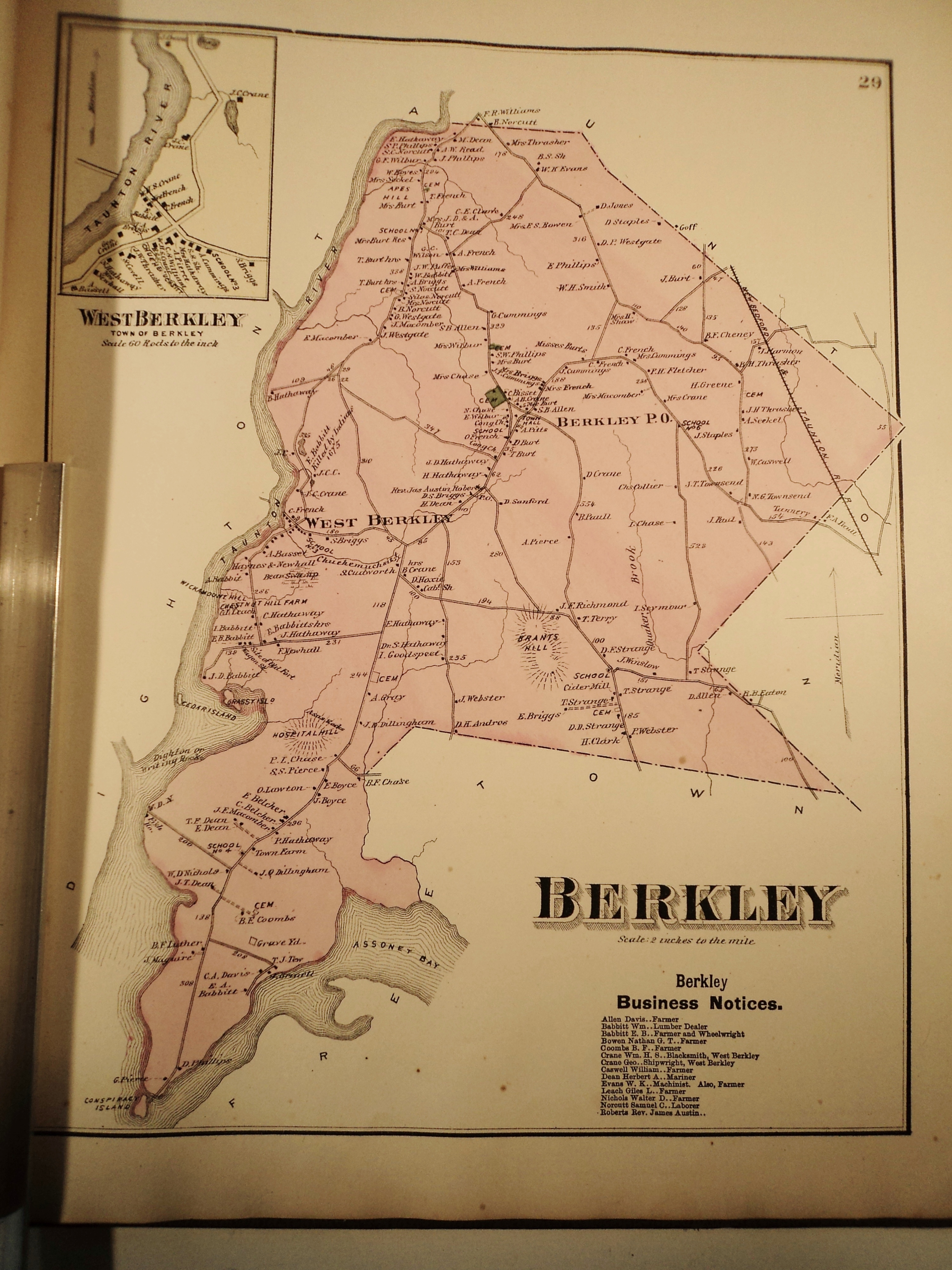
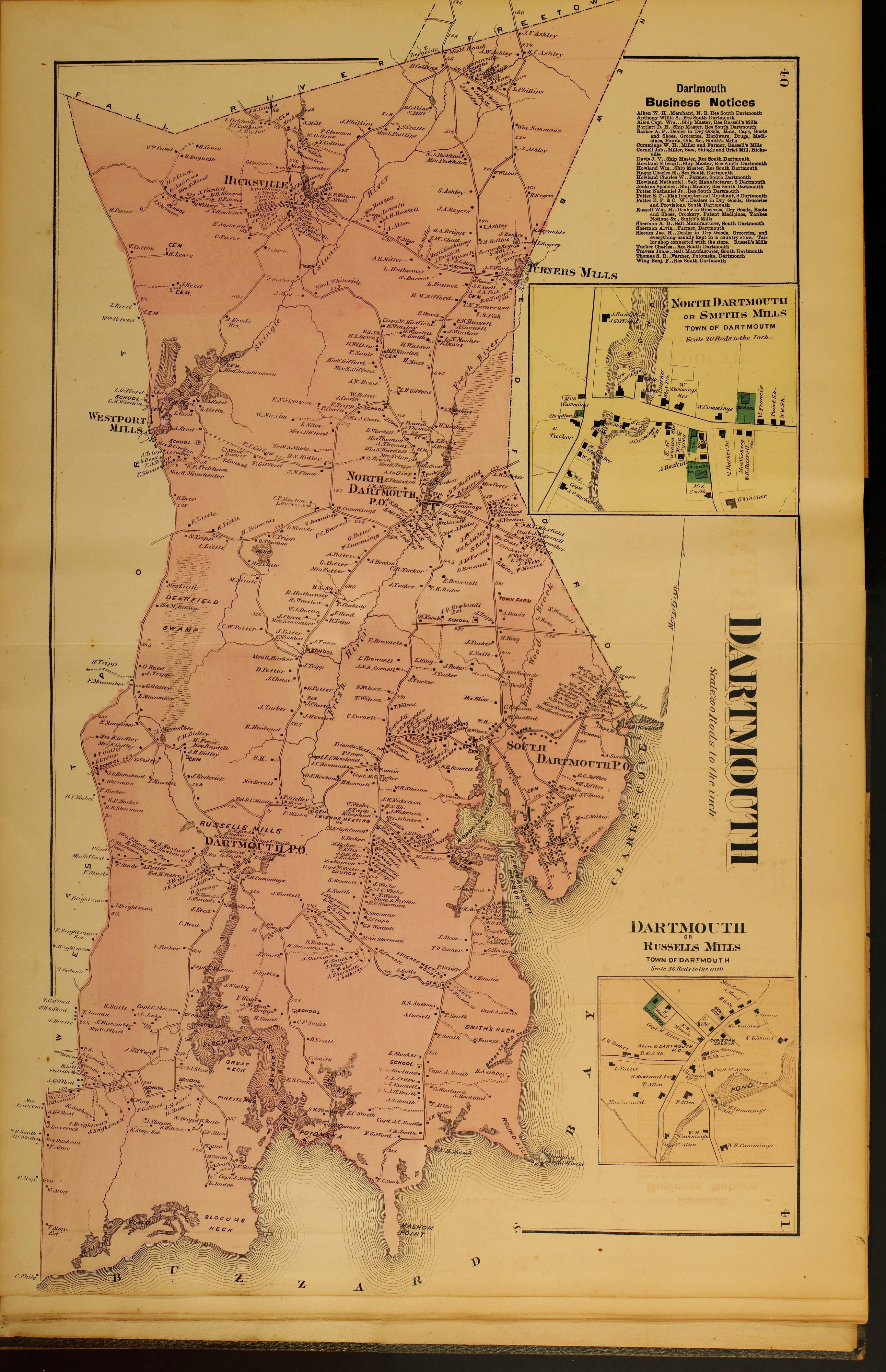
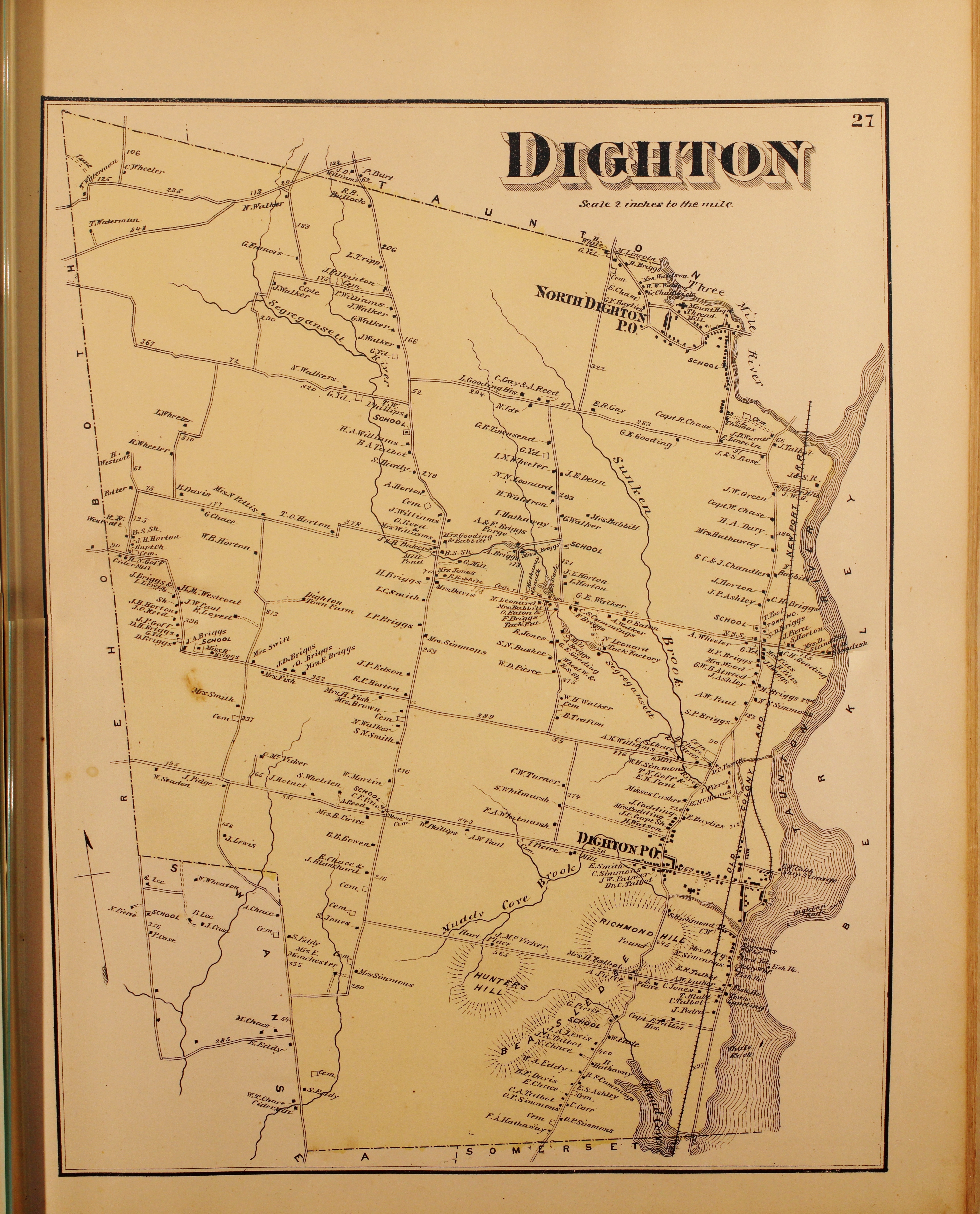
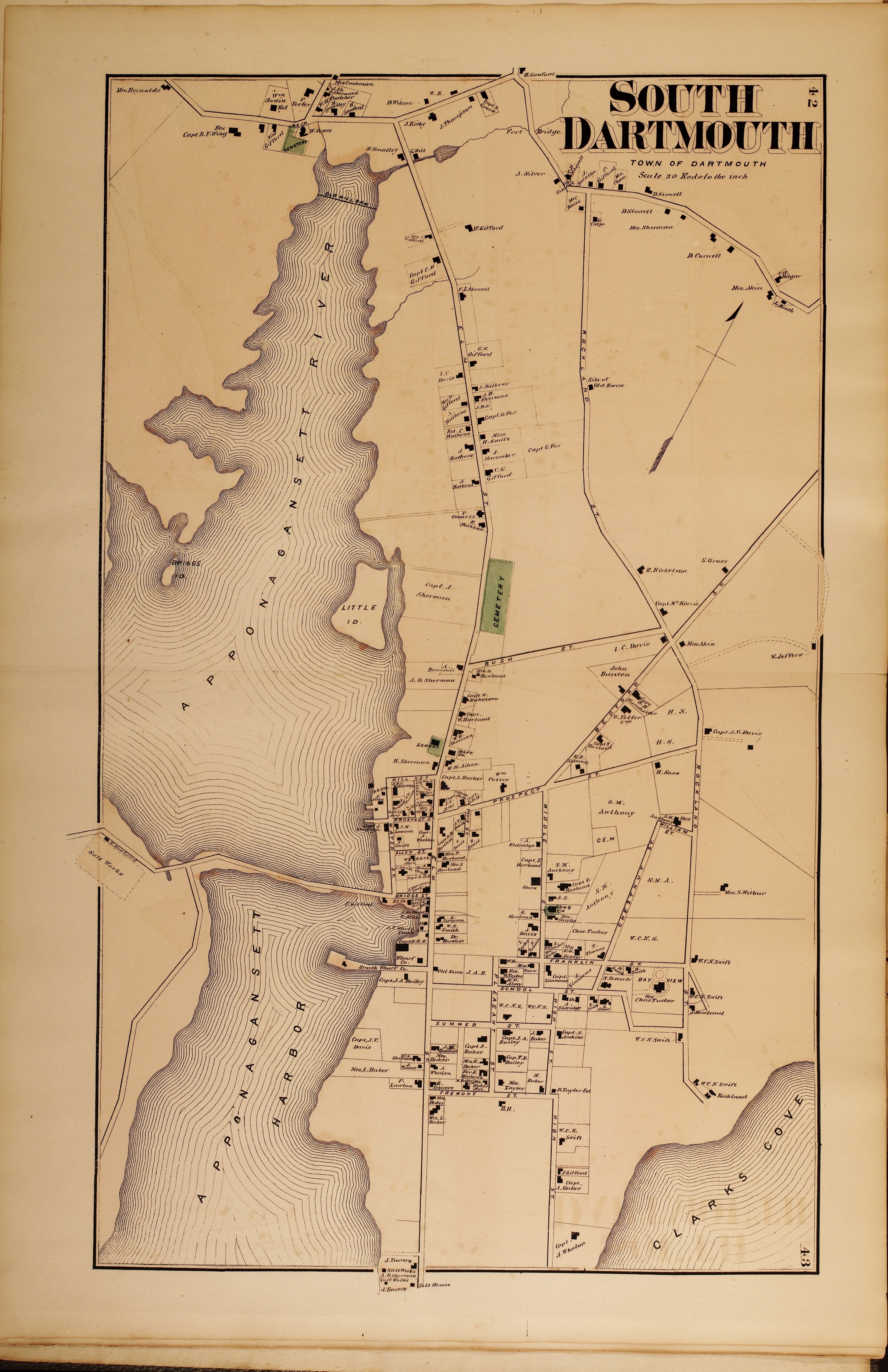
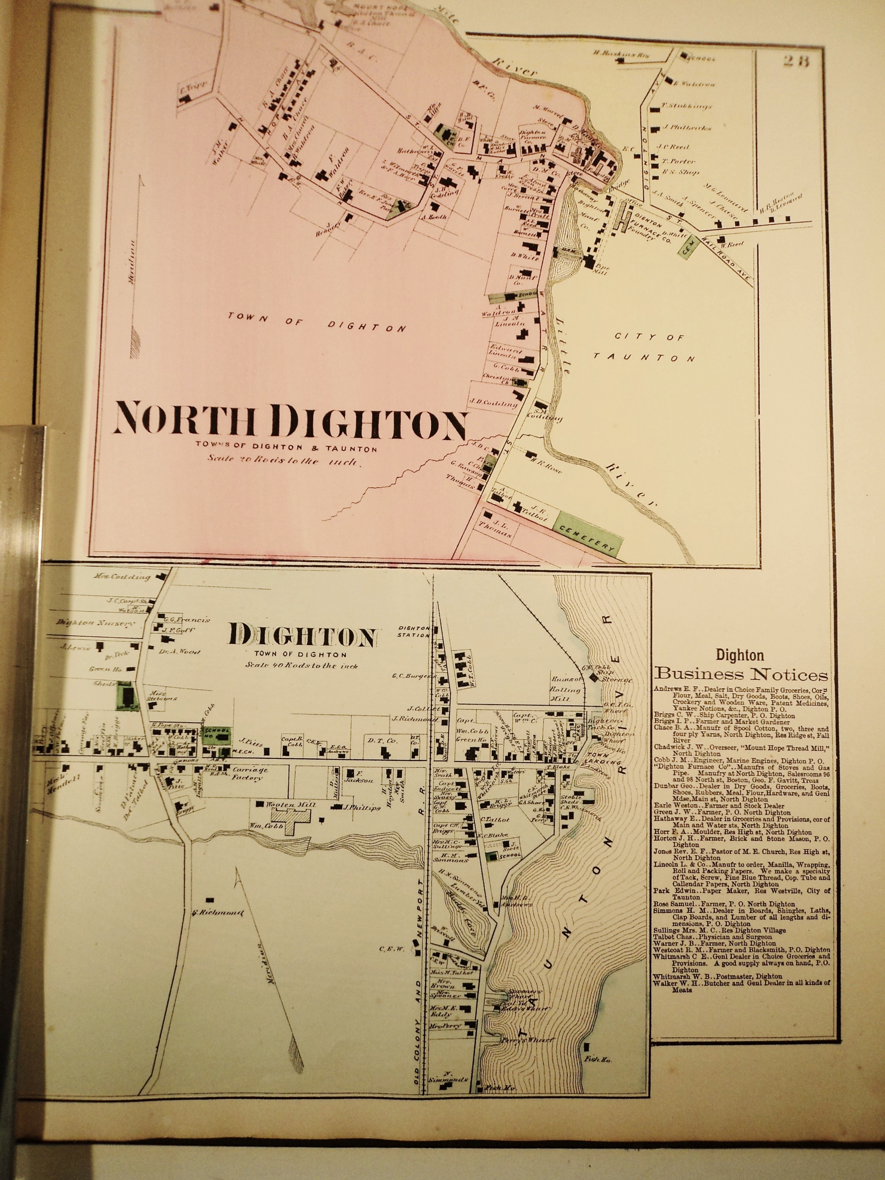
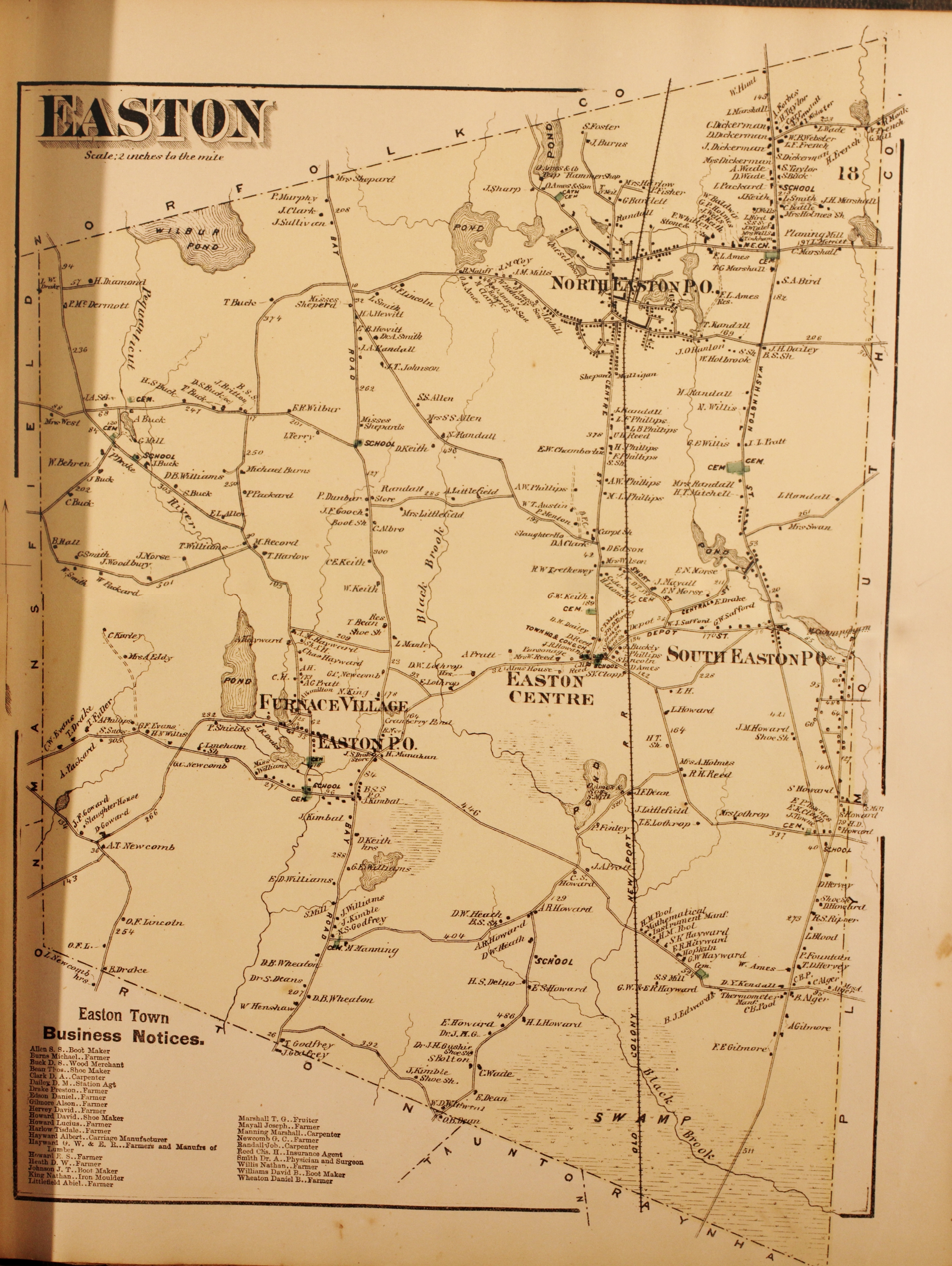
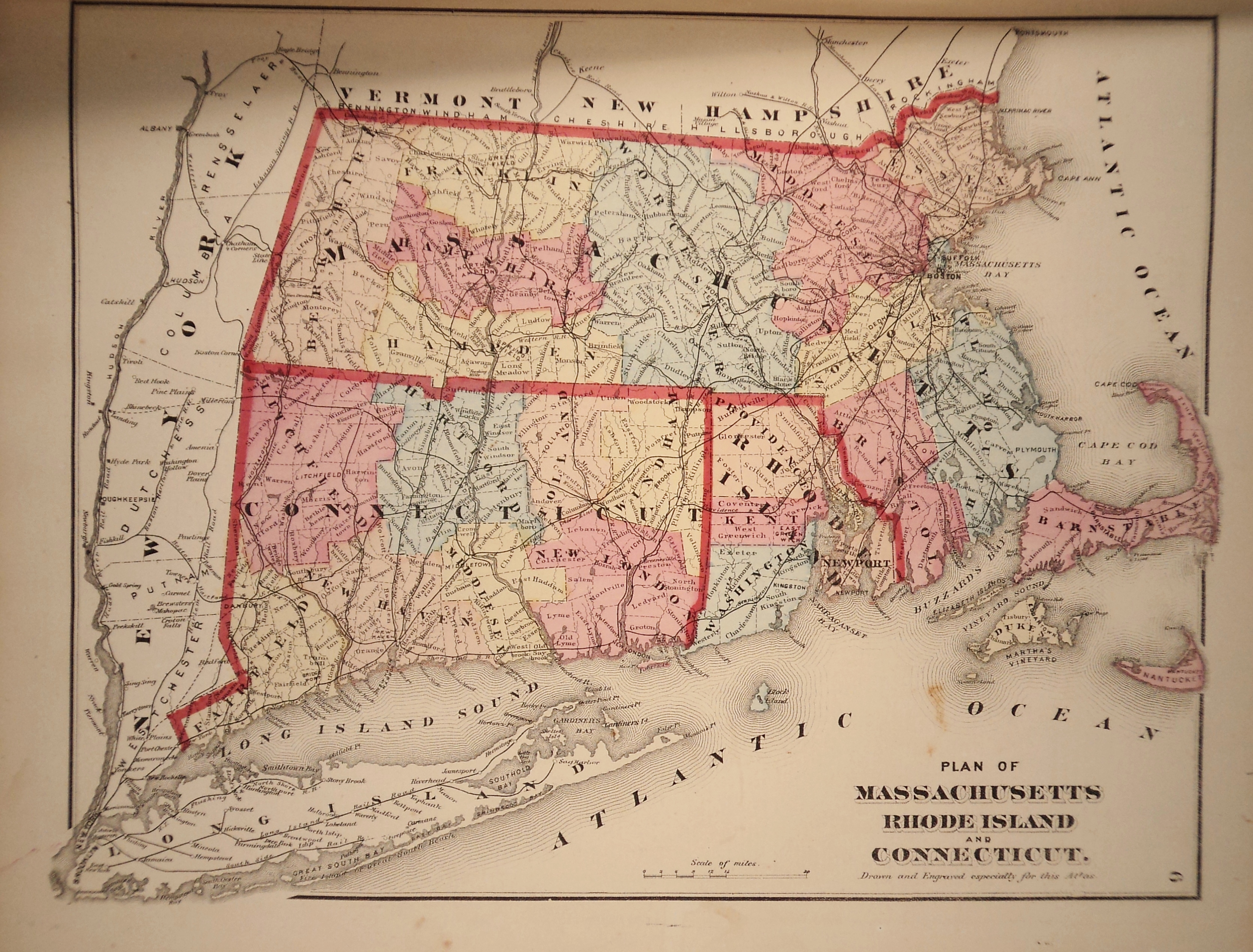
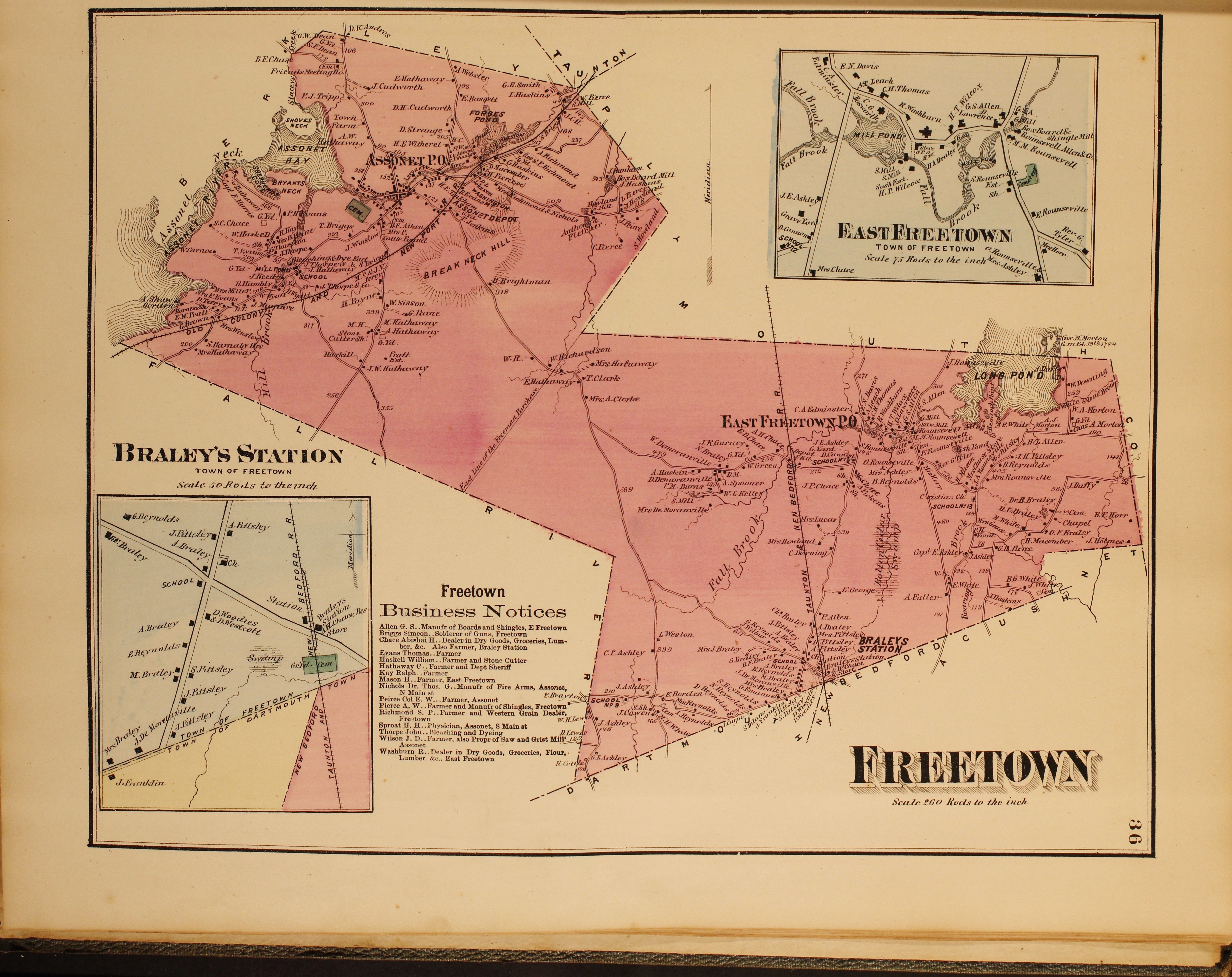
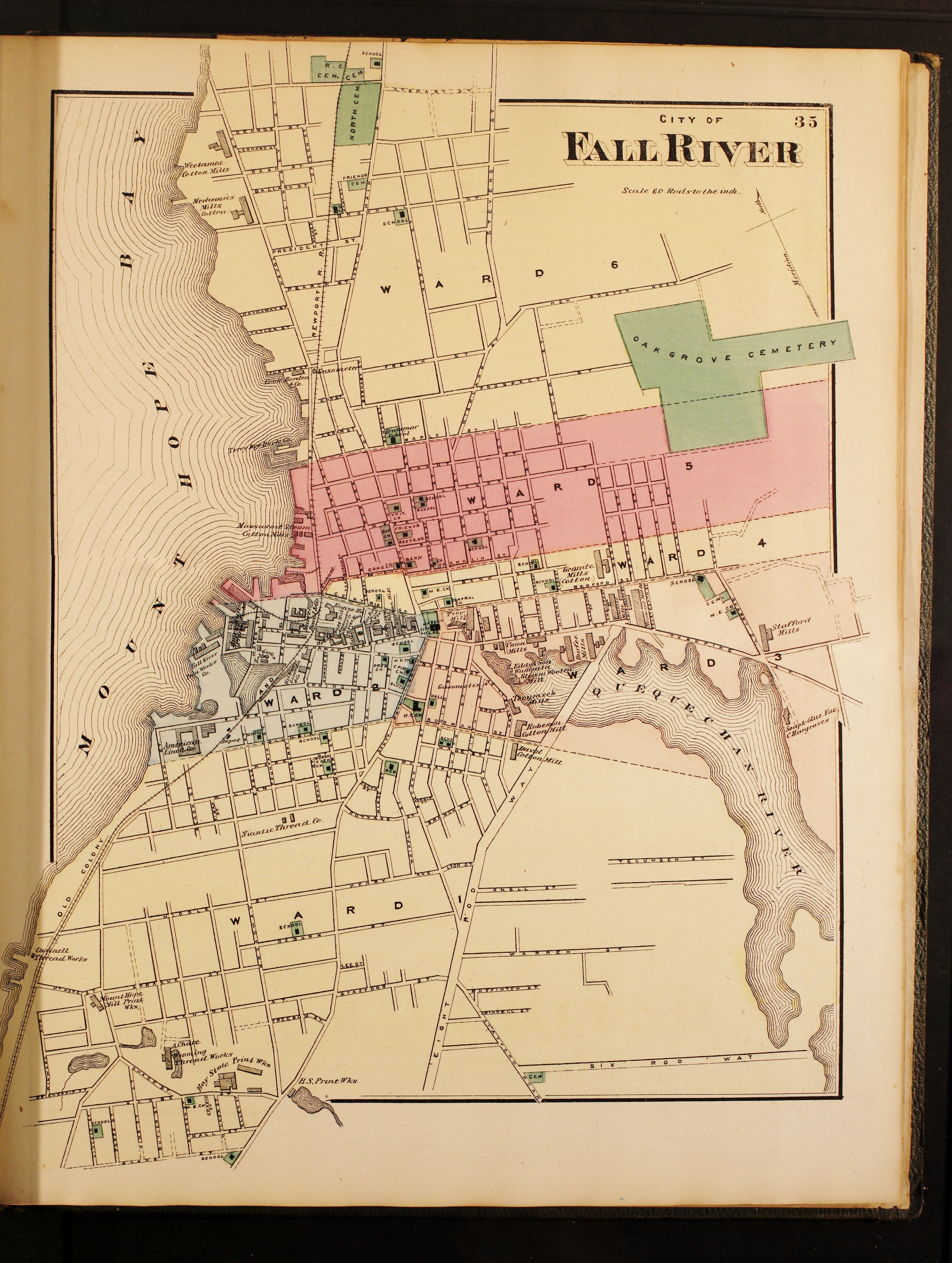
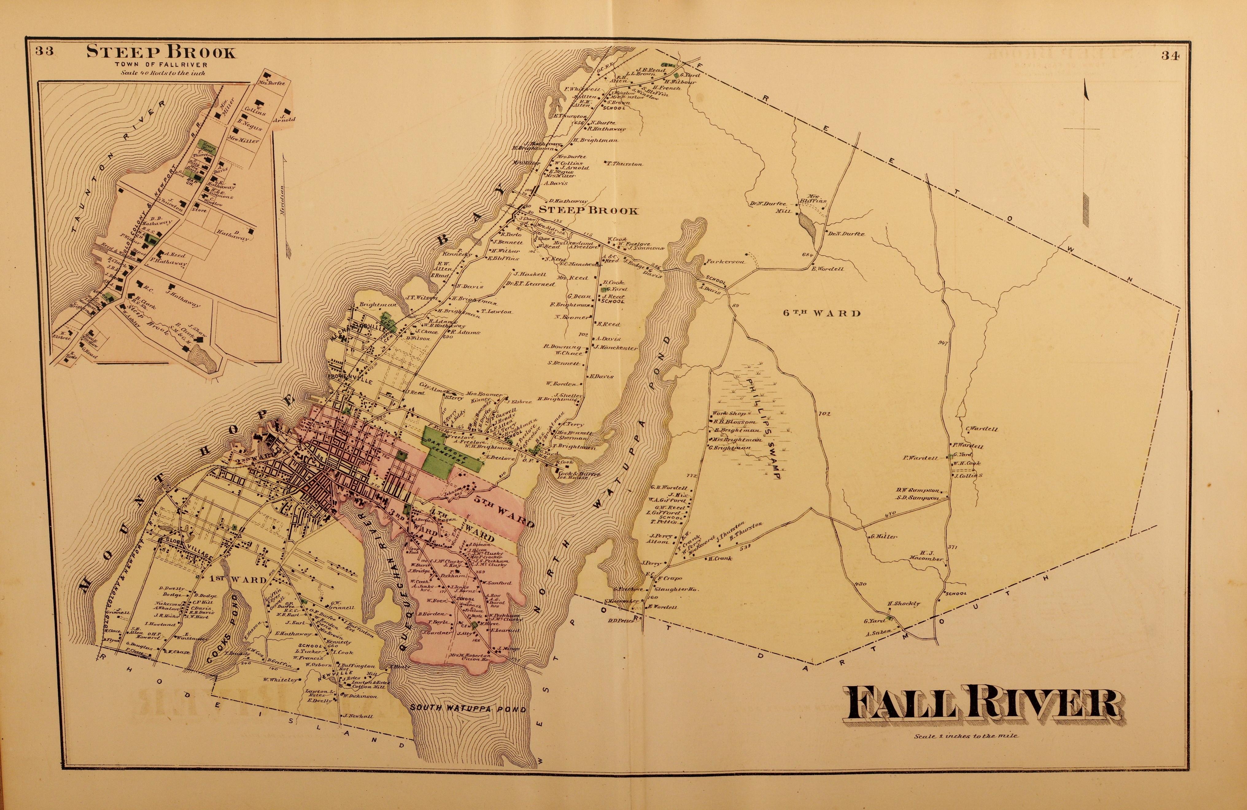
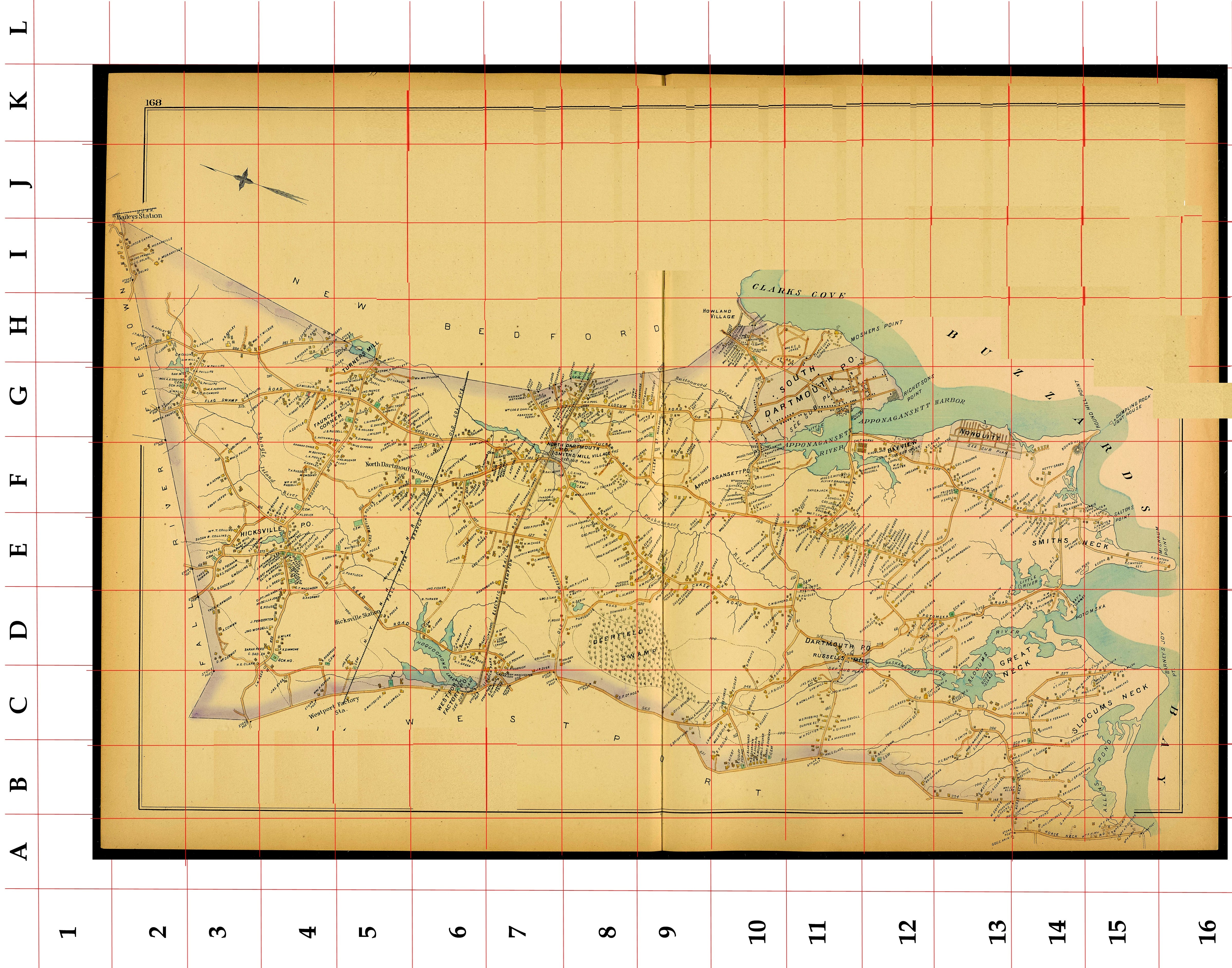
1871 F W Beers Atlas Maps for Bristol County
Click maps below.
Click maps below.

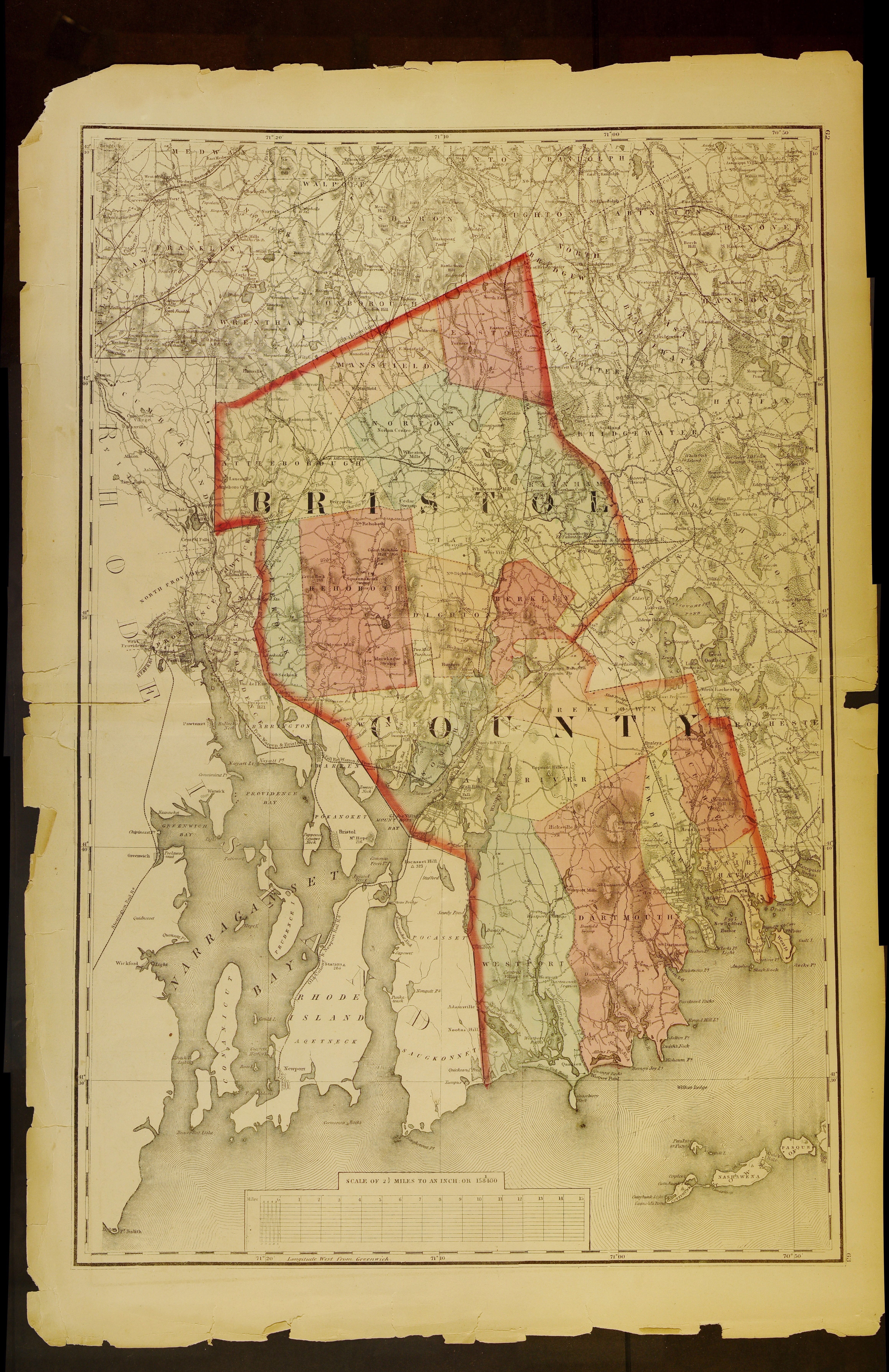
Bristol County 1852
Click here for link.
Click here for link.
1891 George H Walker Map of Massachusetts
Click map below.
Click map below.
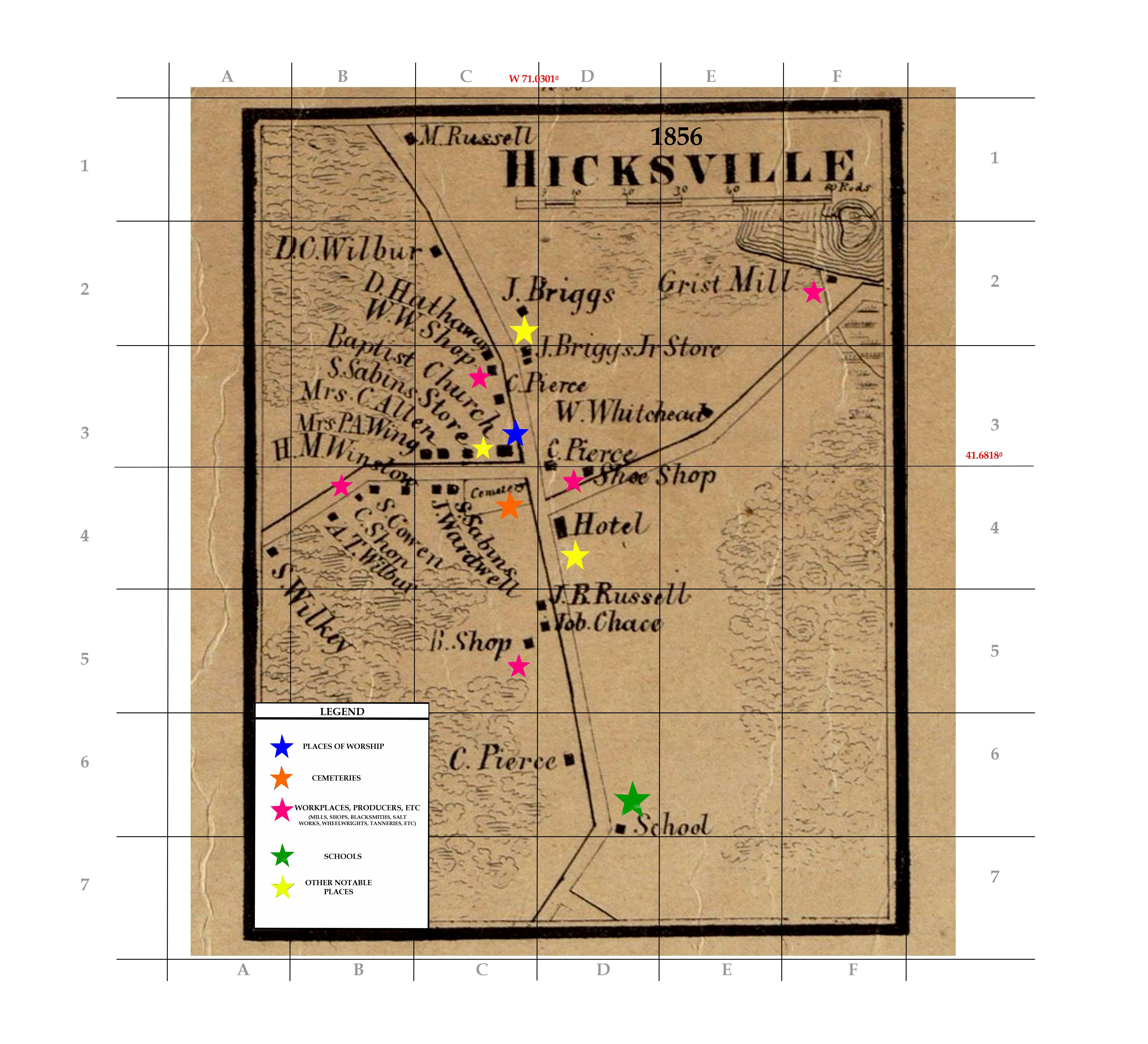
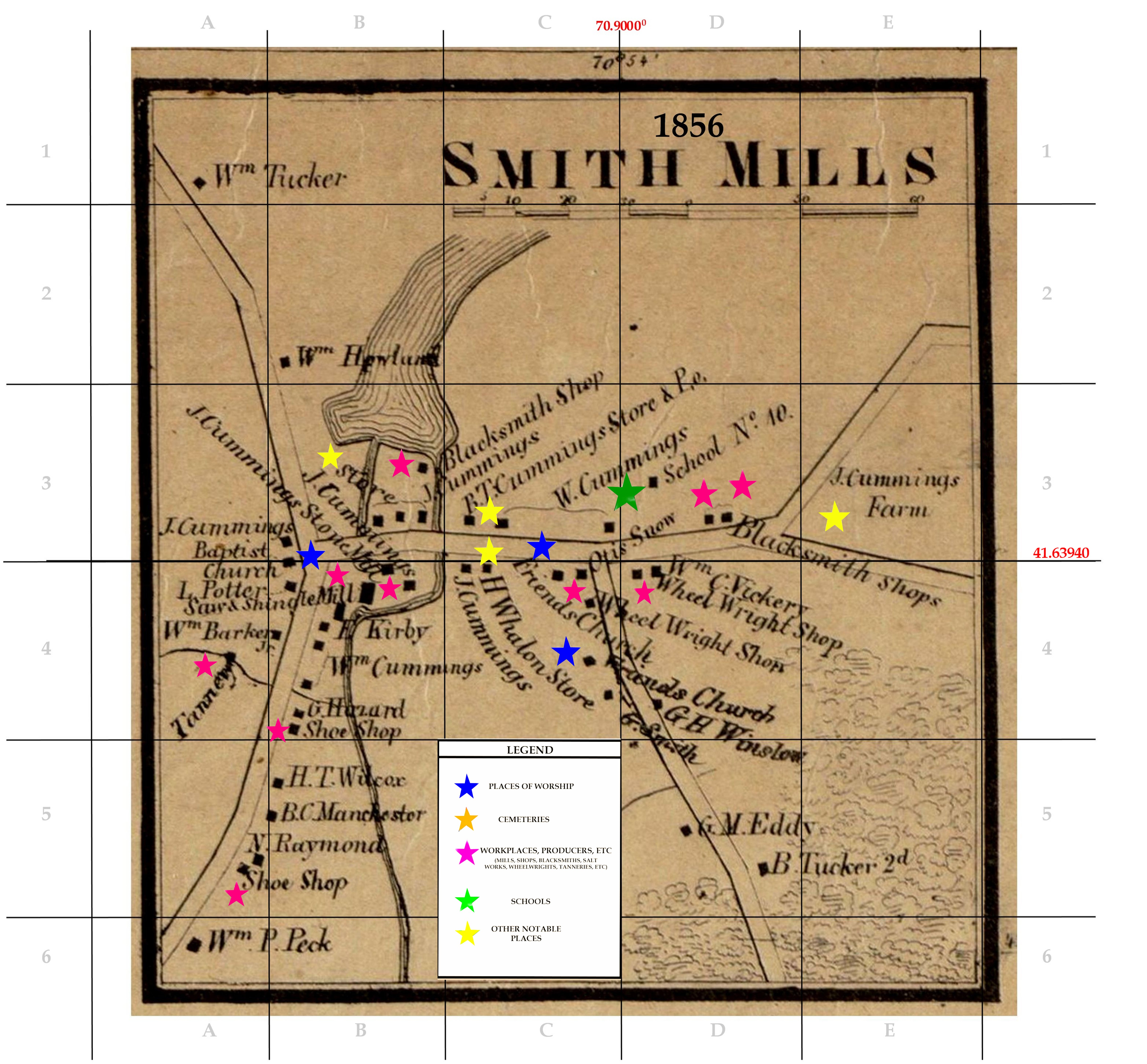
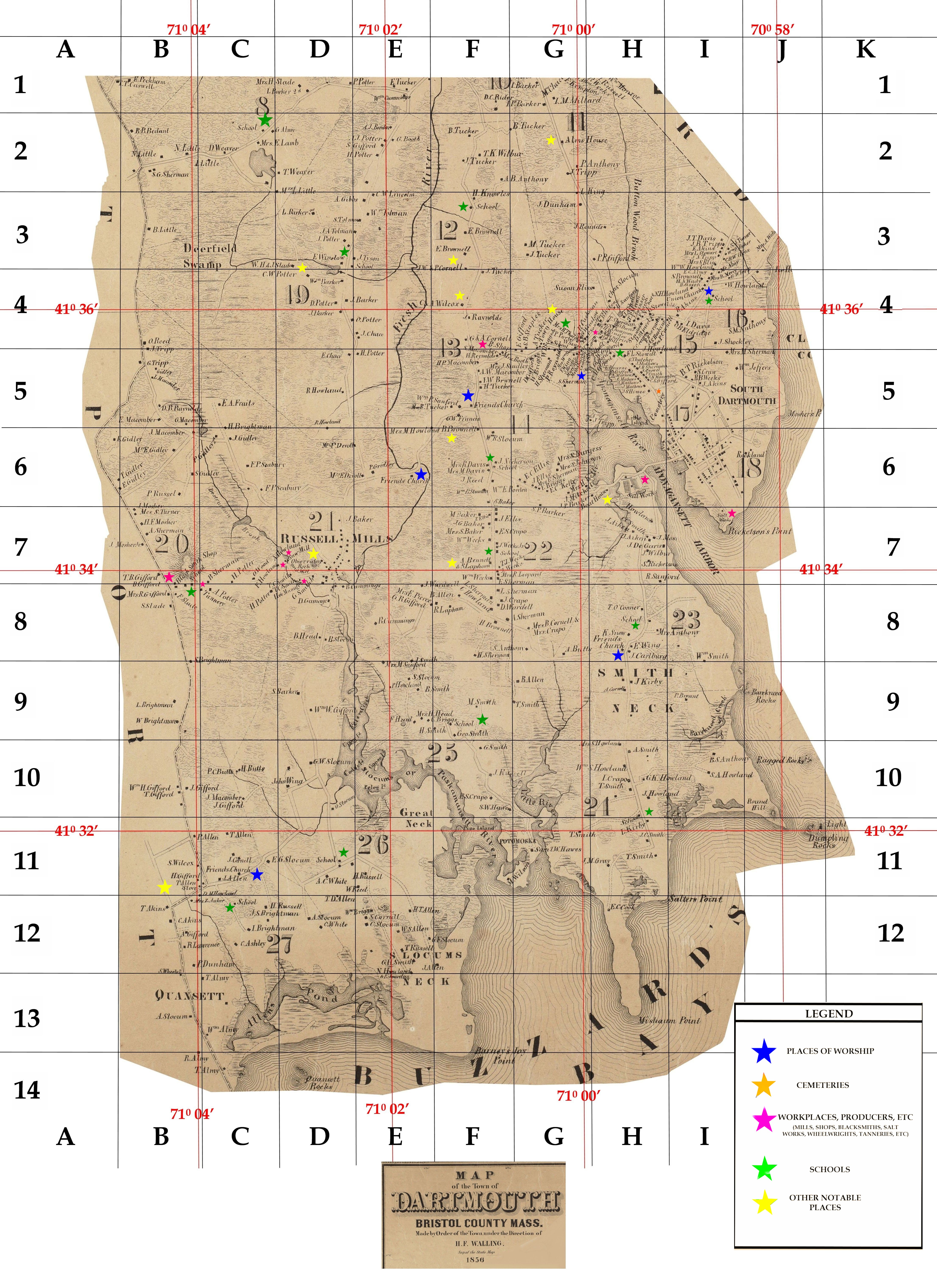
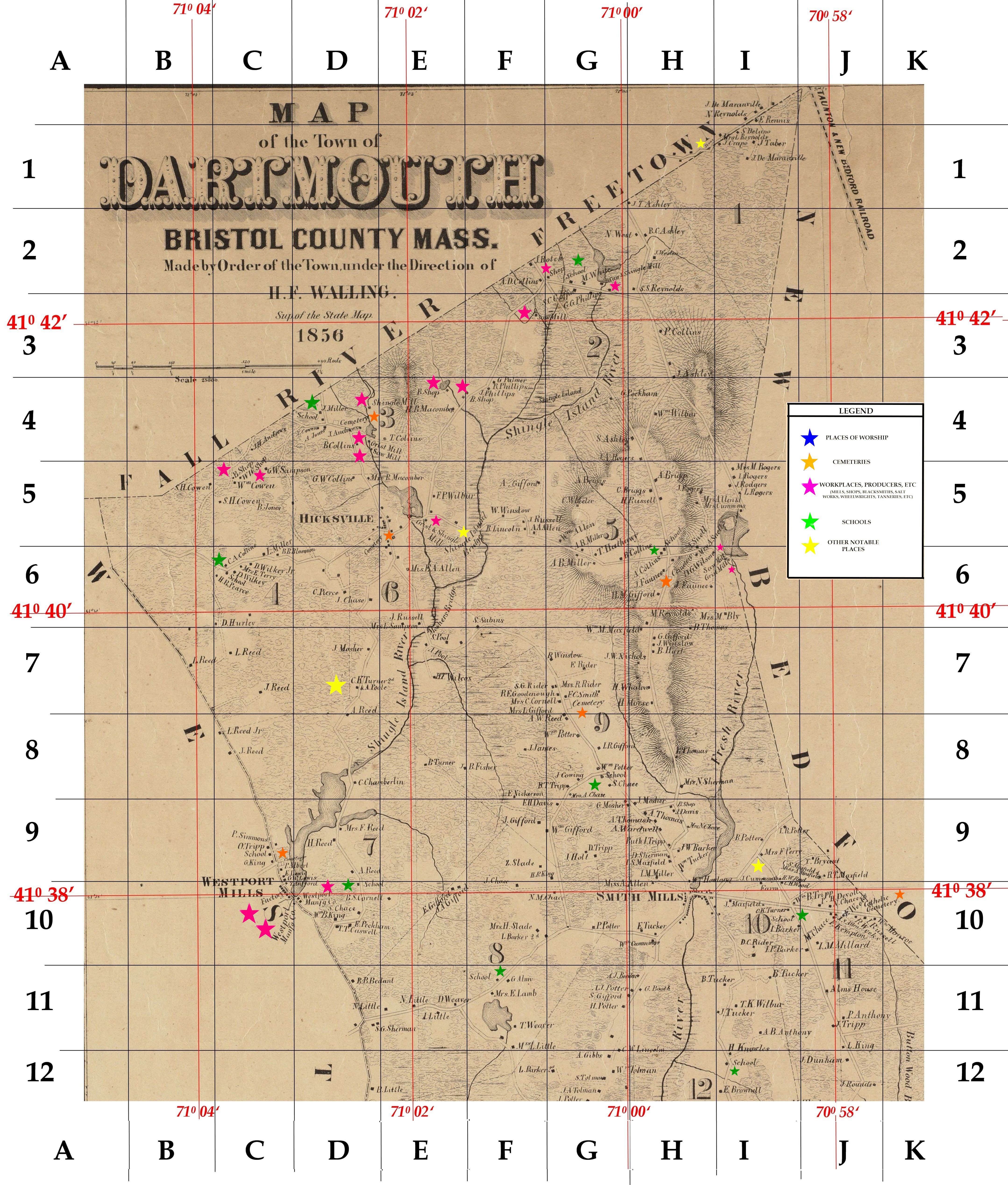
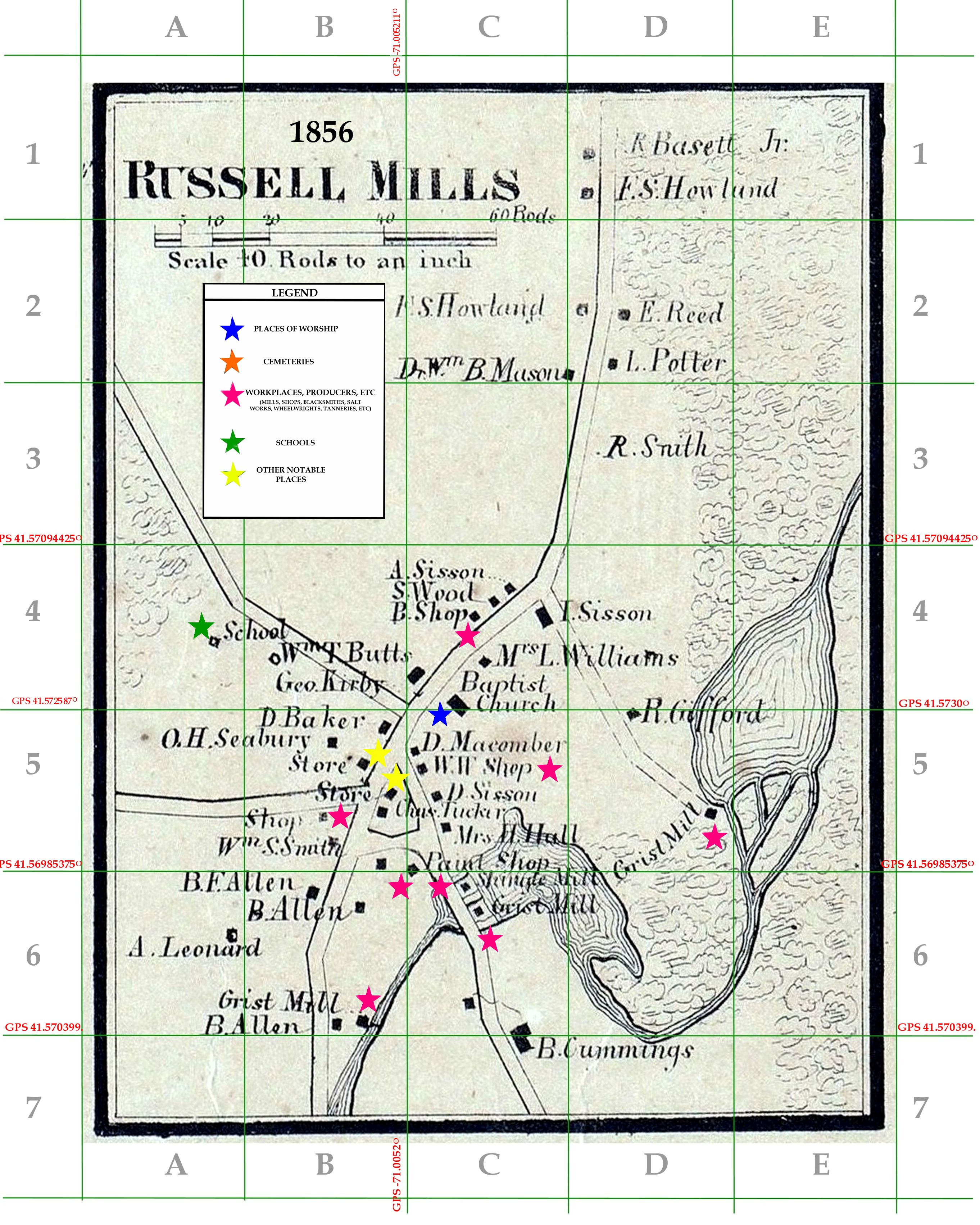
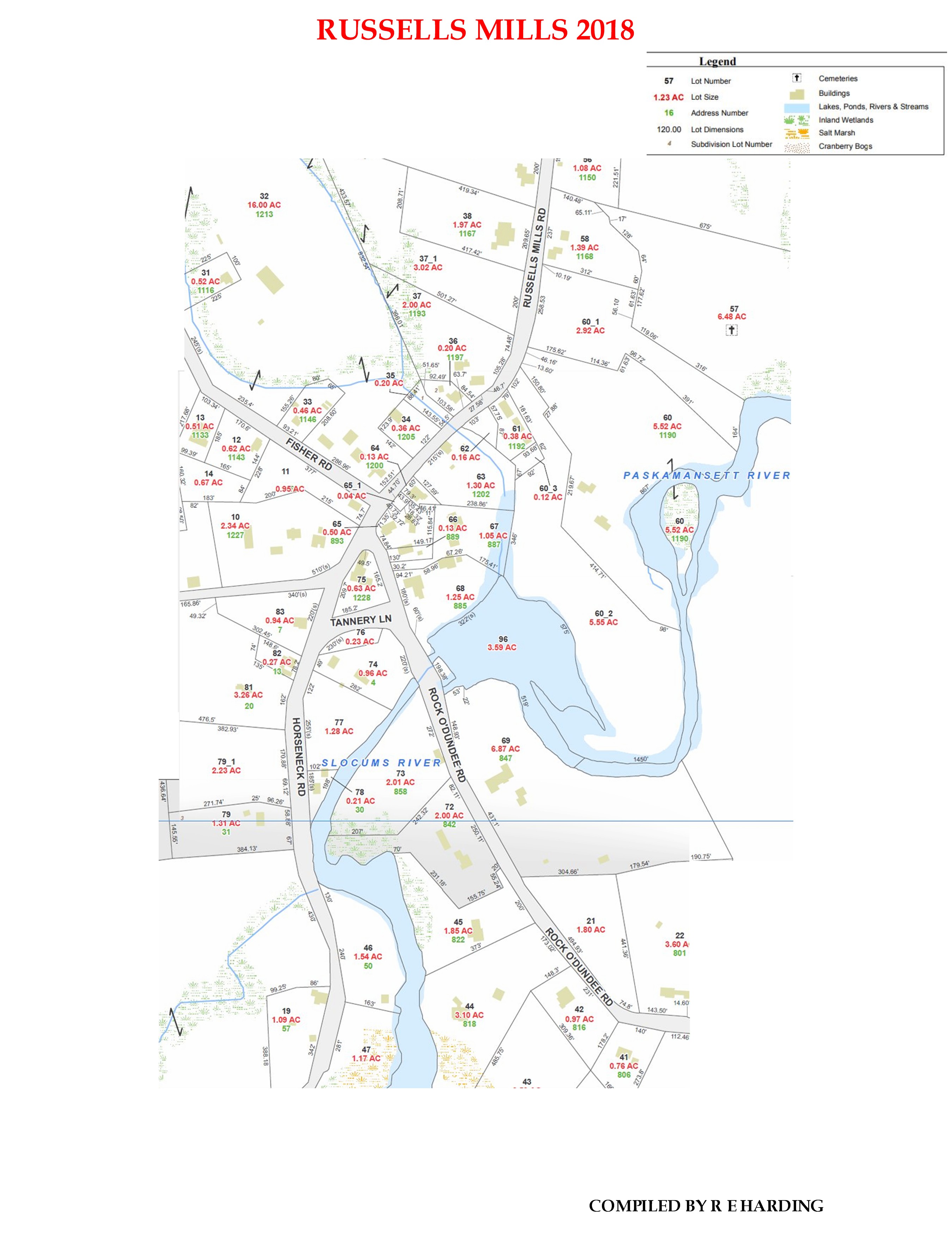
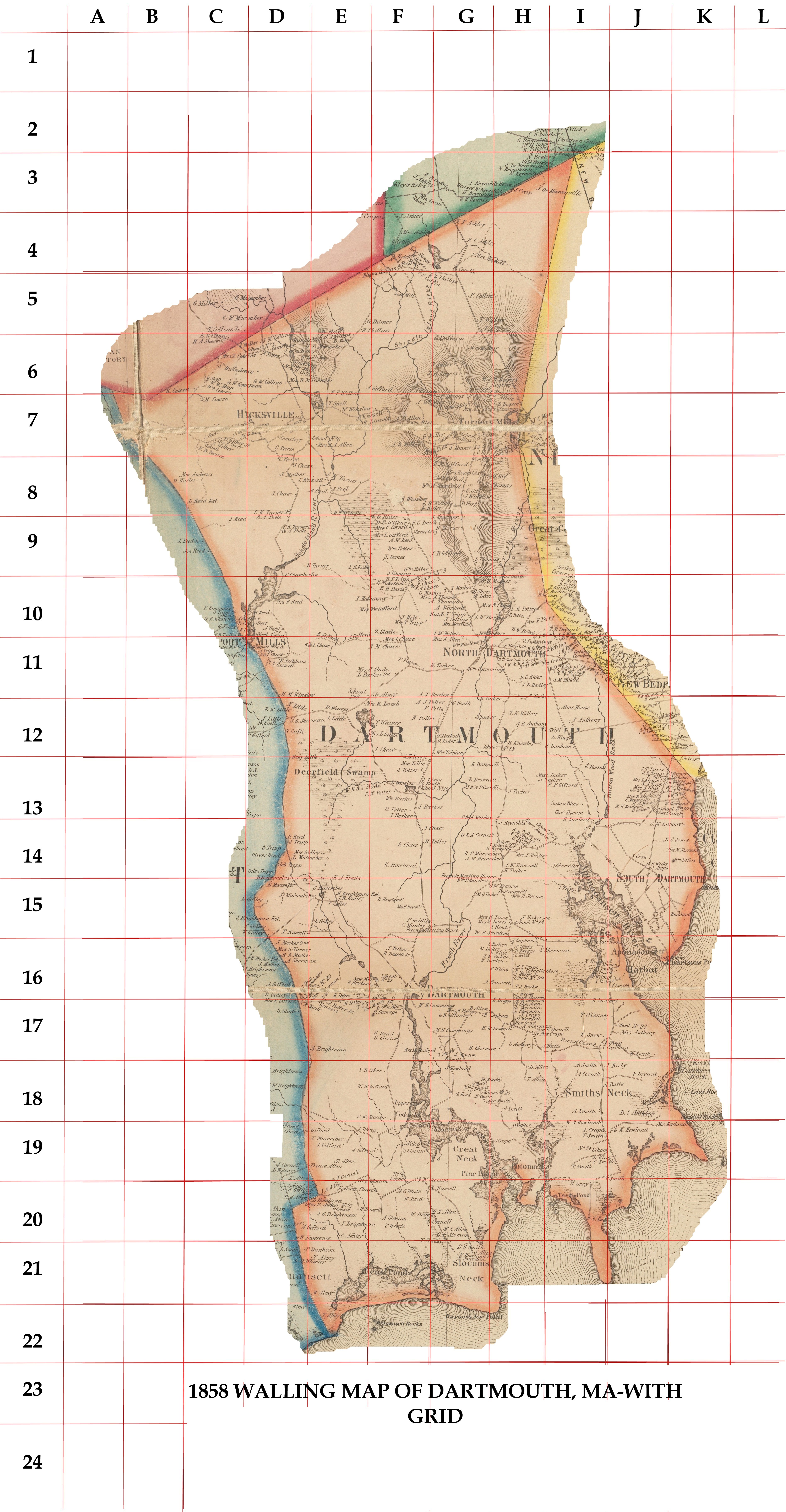
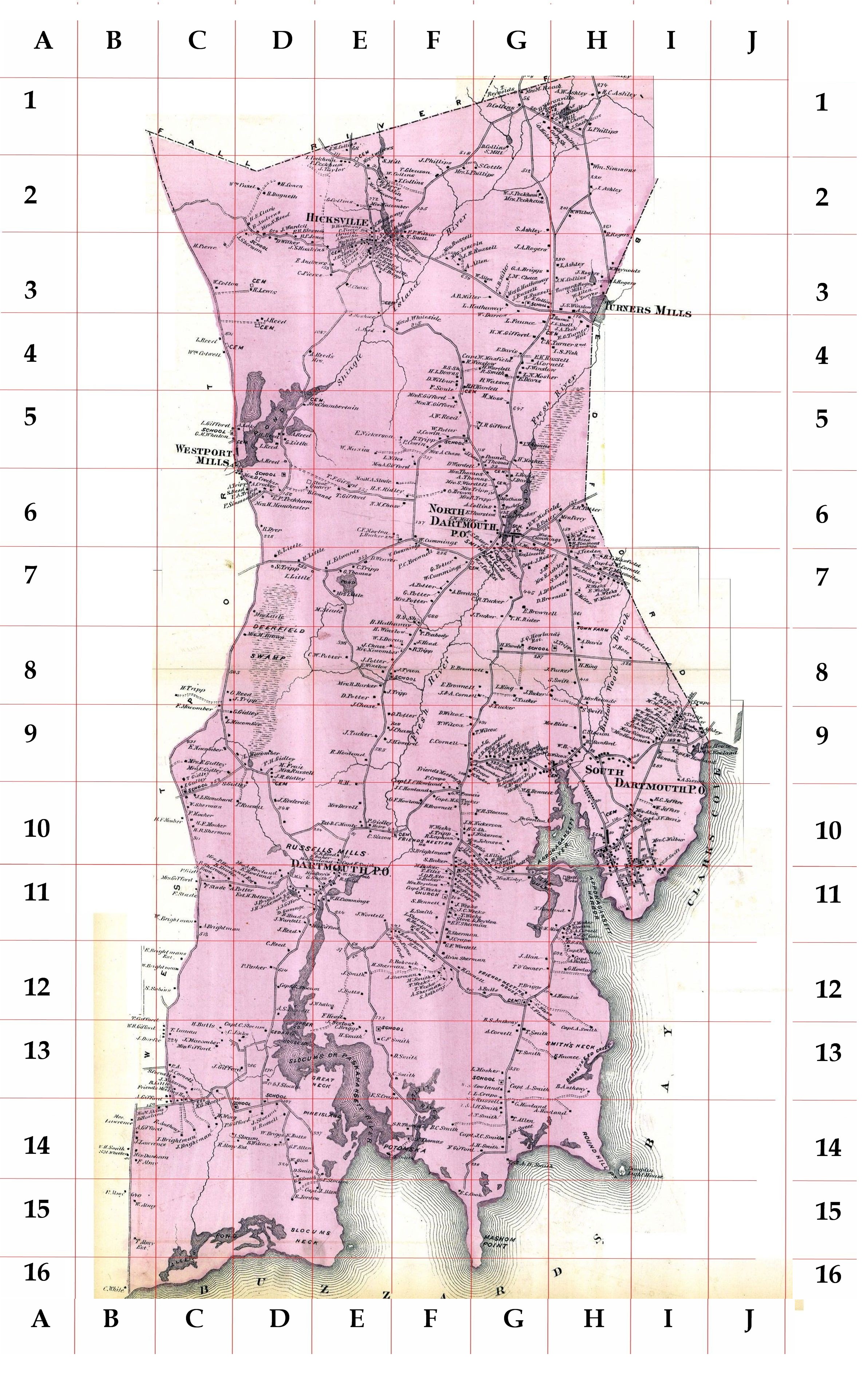
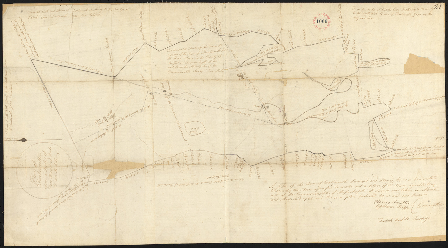
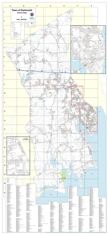
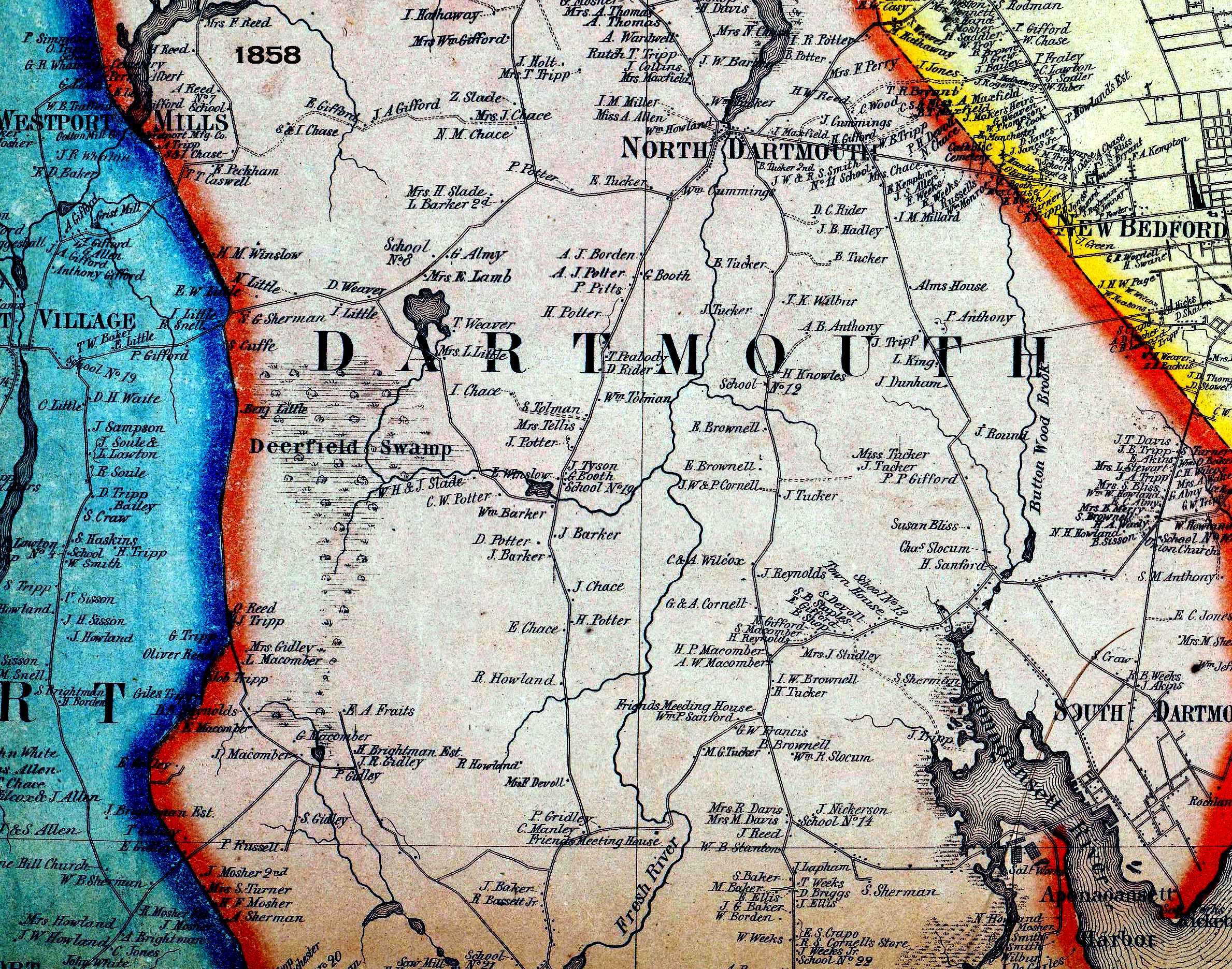
All Dartmouth Maps Past to Present
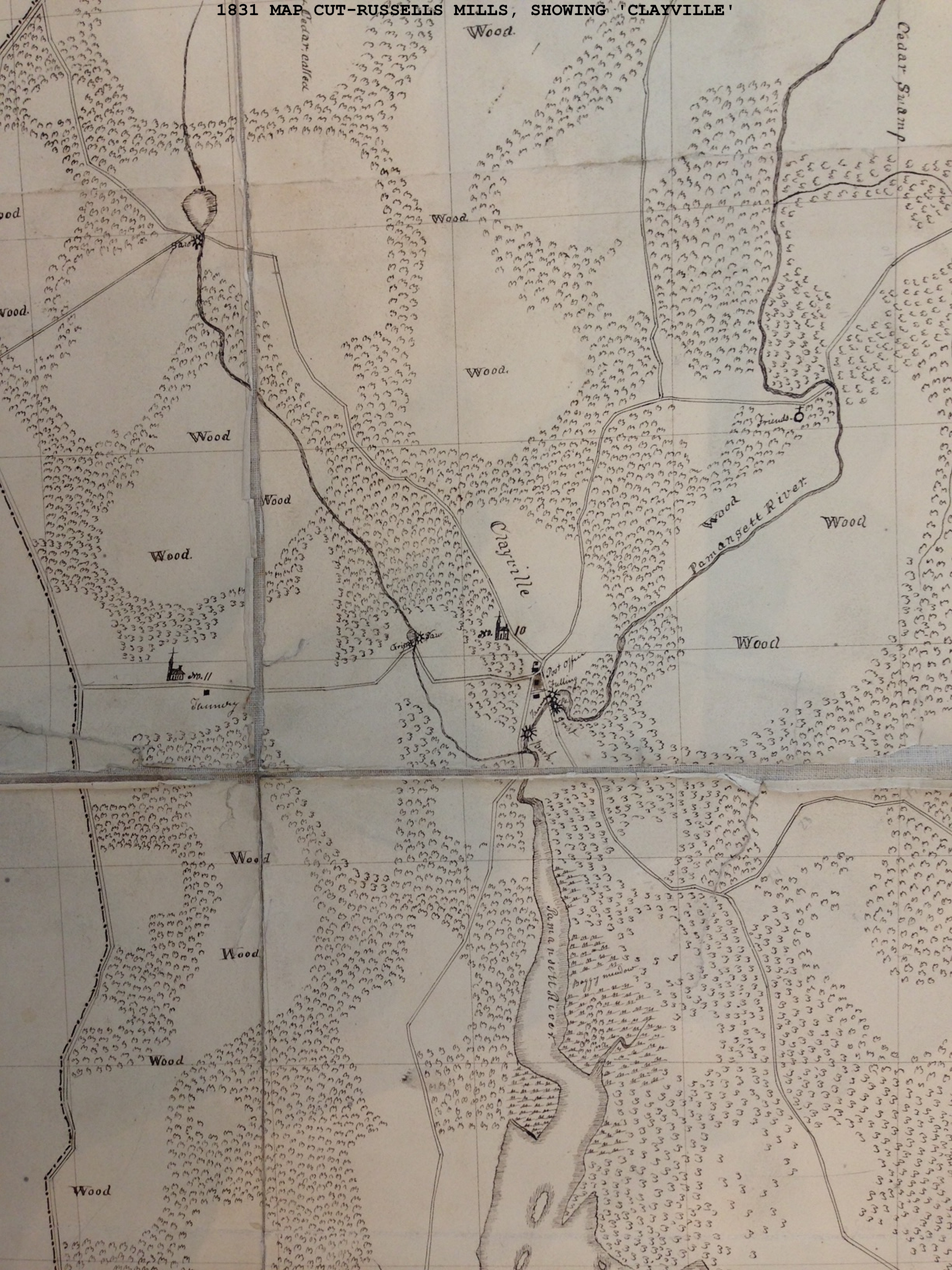
Dartmouth Villages, Bedford and Fair Haven - 1778, A Revolutionary war map by British Major John Andre
|
New Bedford 1795 - unknown surveyor (Link to source)
|
|
|
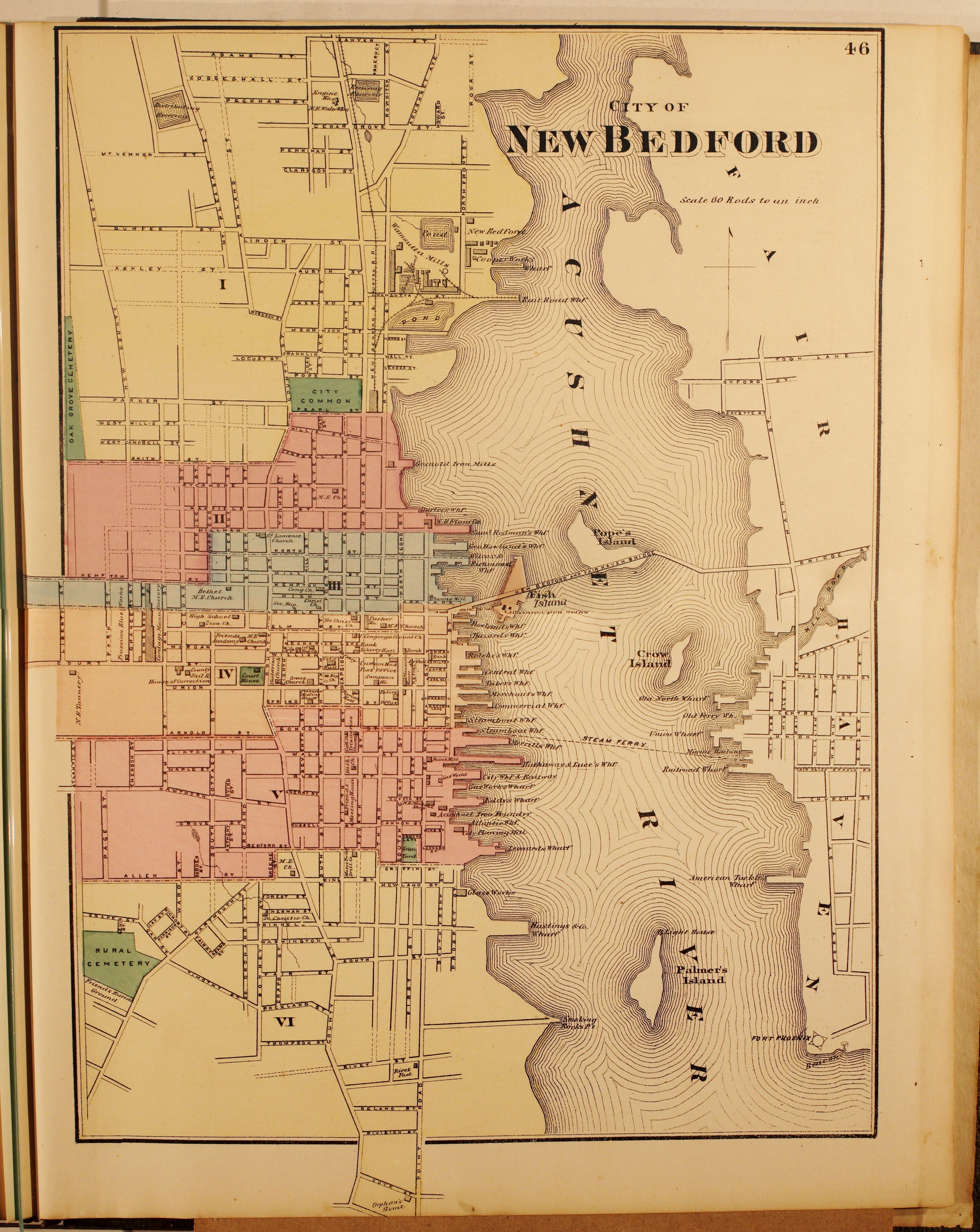
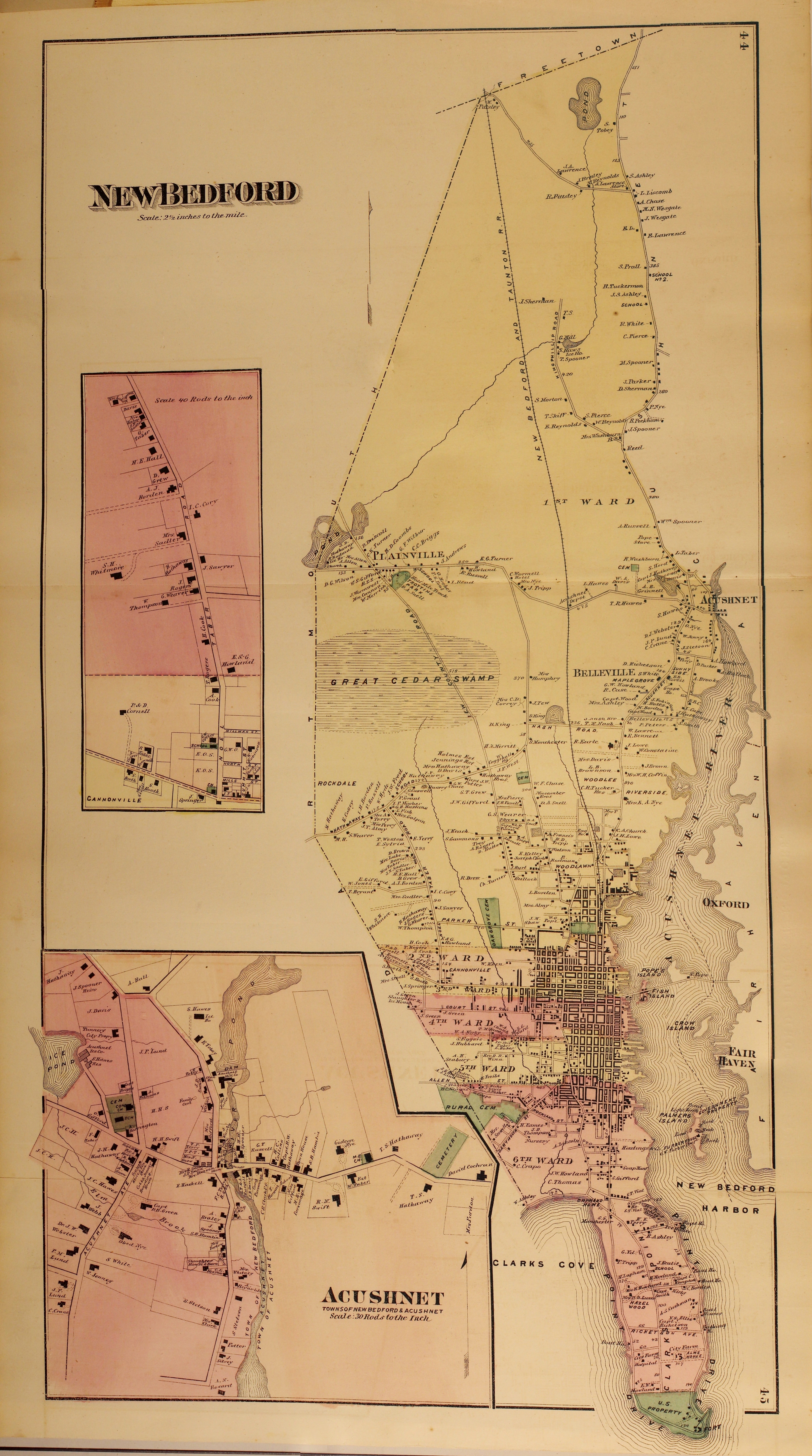
New Bedford Atlas 1881 (Link to online viewer)
|
|
Fairhaven 1852 Grid map Index
Westport 1795 - Zedock Maxfeld (Link to source)
Westport 1852 Grid map Index
Westport 1858 Grid Map
Tiverton, Ri Circa 1790 from Peleg Burroughs journal
Rhode Island borders Circa 1790 from Peleg Burroughs Journal